


Click Image to Enlarge
Minnesota Counties
There are eighty-seven Counties in Minnesota. On October 27, 1849 nine large Minnesota Counties were created. Among them were Benton, Dahkotah, Itasca, Ramsey, Mahkahta, Pembina, Wabashaw, Washington, and Wahnata. Of those Benton, Dakota, Itasca, Ramsey, Wabasha, and Washington still exist as their original name. With the creation of Kittson County on March 9, 1878, Pembina County no longer existed. When Minnesota was organized as a state, 57 of the present 87 Counties were established. The last county to be created was Lake of the Woods County in 1923McLeod County, Minnesota
McLeod County Education, Geography, and History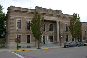
McLeod County is a county located in the state of Minnesota. Based on the 2010 census, the population was 36,651. Its county seat is
Glencoe.
McLeod County comprises the Hutchinson, MN Micropolitan Statistical Area and is included in the Minneapolis-St. Paul, MN-WI Combined
Statistical Area.
Etymology - Origin of McLeod County Name
The county was named after Martin McLeod, a Canadian-born adventurer who became a fur trader and later was elected a territorial representative (1849-1856) in Minnesota. As a young man, he was part of the notable James Dickson 1836 expedition to the Red River of the North, a journey recounted in his Diary of Martin McLeod, a manuscript held by the Minnesota Historical Society.
Demographics:
County QuickFacts: CensusBureau Quick Facts
McLeod County History
For thousands of years the area was inhabited by indigenous peoples. At the time of European contact, it was the territory of the Dakota Sioux.
McLeod County was created on March 1, 1856 from Carver County and Sibley County. The county was named in honor of Martin McLeod, pioneer fur trader, member of the council in the territorial legislature, 1849-53; one of the founders of the City of Glencoe, 1855. The County Seat is located in Glencoe
Geography: Land and Water
As reported by the Census Bureau, the county has a total area of 506 square miles (1,310 km2), of which 491 square miles (1,270 km2) is land and 14 square miles (36 km2) (2.8%) is water. McLeod is one of seven southern Minnesota Counties with no native forests. Only savanna and prairie soils exist in McLeod County.
Neighboring Counties
Bordering counties are as follows:
- Wright County (northeast)
- Carver County (east)
- Sibley County (south)
- Renville County (west)
- Meeker County (northwest)
Education


Click Image to Enlarge
