


Click Image to Enlarge
Minnesota Counties
There are eighty-seven Counties in Minnesota. On October 27, 1849 nine large Minnesota Counties were created. Among them were Benton, Dahkotah, Itasca, Ramsey, Mahkahta, Pembina, Wabashaw, Washington, and Wahnata. Of those Benton, Dakota, Itasca, Ramsey, Wabasha, and Washington still exist as their original name. With the creation of Kittson County on March 9, 1878, Pembina County no longer existed. When Minnesota was organized as a state, 57 of the present 87 Counties were established. The last county to be created was Lake of the Woods County in 1923Mille Lacs County, Minnesota
Mille Lacs County Education, Geography, and History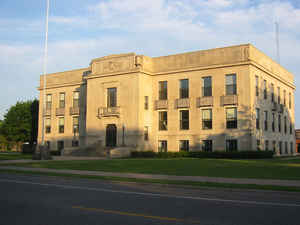
Mille Lacs County is a county located in the state of Minnesota. Based on the 2010 census, the population was 26,097. Its county seat is
Milaca. The county was founded in 1857, and its boundary was expanded in 1860.
Mille Lacs County is included in the Minneapolis-St. Paul-Bloomington, MN-WI Metropolitan Statistical Area.
A portion of the Mille Lacs Indian Reservation is in the county.
Etymology - Origin of Mille Lacs County Name
The name Mille Lacs, meaning "thousand lakes" in French, comes from Mille Lacs Lake (French: Grand lac du Pays des Mille Lacs), largest lake in the Brainerd Lakes Area as the area was called "Region of Thousand Lakes" (Pays des Mille Lacs) in French
Demographics:
County QuickFacts: CensusBureau Quick Facts
Mille Lacs County History
Mille Lacs County was organized on May 23, 1857, cleaving off the easternmost portion of Benton County, Minnesota. The original Mille Lacs County consisted of the portion of the contemporary Mille Lacs County east of the west branch of the Rum River and two townships now part of Isanti County, adjacent to Mille Lacs County. In 1858, the 12 townships forming the contemporary southern 10 townships of Mille Lacs County and the 2 northwestern townships in Isanti County were organized apart from either Benton or Mille Lacs County to form Monroe County, leaving the northern "Square Top-knot" as the Mille Lacs County. In 1860, Monroe and Mille Lacs Counties merged. Shortly thereafter, the two southeastern townships were transferred to Isanti County, forming the contemporary boundaries for the county.
Geography: Land and Water
As reported by the Census Bureau, the county has a total area of 682 square miles (1,770 km2), of which 572 square miles (1,480 km2) is land and 109 square miles (280 km2) (16%) is water.
Neighboring Counties
Bordering counties are as follows:
- Aitkin County (north)
- Kanabec County (northeast)
- Isanti County (southeast)
- Sherburne County (south)
- Benton County (southwest)
- Morrison County (west)
- Crow Wing County (northwest)
Education


Click Image to Enlarge
