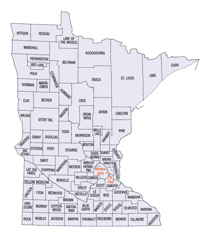
Minnesota Counties
There are eighty-seven Counties in Minnesota. On October 27, 1849 nine large Minnesota Counties were created. Among them were Benton, Dahkotah, Itasca, Ramsey, Mahkahta, Pembina, Wabashaw, Washington, and Wahnata. Of those Benton, Dakota, Itasca, Ramsey, Wabasha, and Washington still exist as their original name. With the creation of Kittson County on March 9, 1878, Pembina County no longer existed. When Minnesota was organized as a state, 57 of the present 87 Counties were established. The last county to be created was Lake of the Woods County in 1923Pipestone County, Minnesota
Pipestone County Education, Geography, and History
Pipestone County is a county located in the state of Minnesota. Based on the 2010 census, the population was 9,596. Its county seat is
Pipestone. The county was founded in 1857 and organized in 1879. The county was named for deposits of red pipestone used by Indians to make
pipes.
Etymology - Origin of Pipestone County Name
Named for sacred Dakota quarry of red pipestone found in the county, used in the making of ceremonial pipes
Demographics:
County QuickFacts: CensusBureau Quick Facts
Pipestone County History
Pipestone County was created on May 23, 1857 (Organized in 1879) from Brown County. The county was named for sacred Dakota quarry of red pipestone found in the county, used in the making of ceremonial pipes. (County was originally called Rock County and Rock County used to be called Pipestone County. The Counties swapped names in 1862. The County Seat is located in Pipestone
Geography: Land and Water
As reported by the Census Bureau, the county has a total area of 466 square miles (1,210 km2), of which 465 square miles (1,200 km2) is land and 0.9 square miles (2.3 km2) (0.2%) is water.
Pipestone County was originally a stretch of rich upland prairie. Ecologically, our region is known as the Tall Grass Prairie. It was virtually devoid of trees with native grasses growing as tall as 6 to 8 feet throughout much of the county. Pipestone County is situated atop the "Coteau des Prairies", a watershed divide ranging in elevation from 1700 to 2000 feet above sea level, some of the highest land in the state. Waters east of the Coteau flow into the Mississippi River, and those west flow into the Missouri. Animal inhabitants at one time included bison, elk, cougar, wolves, prairie chickens, and the county's numerous acres of wetlands abounded with water fowl and other birds. This was the homeland of the Dakota Indians, nomadic hunters, who lived in close harmony with nature as they traveled through this area.
Neighboring Counties
Bordering counties are as follows:
- Lincoln County (north)
- Lyon County (northeast)
- Murray County (east)
- Rock County (south)
- Minnehaha County, South Dakota (southwest)
- Moody County, South Dakota (west)
- Brookings County, South Dakota (northwest)
Education


