


Click Image to Enlarge
Minnesota Counties
There are eighty-seven Counties in Minnesota. On October 27, 1849 nine large Minnesota Counties were created. Among them were Benton, Dahkotah, Itasca, Ramsey, Mahkahta, Pembina, Wabashaw, Washington, and Wahnata. Of those Benton, Dakota, Itasca, Ramsey, Wabasha, and Washington still exist as their original name. With the creation of Kittson County on March 9, 1878, Pembina County no longer existed. When Minnesota was organized as a state, 57 of the present 87 Counties were established. The last county to be created was Lake of the Woods County in 1923Rice County, Minnesota
Rice County Education, Geography, and History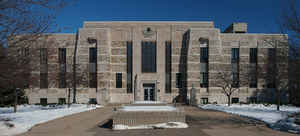
Rice County is a county located in the state of Minnesota. Based on the 2010 census, the population was 64,142. Its county seat is
Faribault.
Rice County comprises the Faribault-Northfield, MN Micropolitan Statistical Area, which is included in the Minneapolis-St. Paul, MN-WI
Combined Statistical Area.
Etymology - Origin of RiceCounty Name
Named for Henry Mower Rice, one of the first two US Senators from Minnesota, 1858-63.
Demographics:
County QuickFacts: CensusBureau Quick Facts
Rice County History
The first time that the Minnesota territorial legislature assembled was in St. Paul during the winter of 1849. At the
direction of Governor Ramsey, the Minnesota territory was divided into districts. By this time, white settlers were in what is now known as
Rice County. The trading post near the present site of Faribault was an active hub of trapping and trade.
A portion of what is now known as Rice County was created by the territorial legislature on March 5, 1853. Subsequent changes and
modifications occurred to the boundaries of Rice County as other counties were created and modified (such as Steele County's creation at a
later date on February 20, 1855.)
Source: 1910 History of Rice and Steele Counties, Vol. 1, Pages 54, 57.
Geography: Land and Water
As reported by the Census Bureau, the county has a total area of 516 square miles (1,340 km2), of which 496 square miles (1,280 km2) is land and 20 square miles (52 km2) (3.9%) is water. The Cannon River flows northeastwardly through the county, collecting the Straight River in Faribault. The North Fork of the Zumbro River has its headwaters in the southeastern part of the county. Rice is one of 17 Minnesota savanna counties with more savanna soils than either prairie or forest soils.
Neighboring Counties
Bordering counties are as follows:
- Dakota County (northeast)
- Goodhue County (east)
- Dodge County (southeast)
- Steele County (south)
- Waseca County (southwest)
- Le Sueur County (west)
- Scott County (northwest)
Education


Click Image to Enlarge
