


Click Image to Enlarge
Minnesota Counties
There are eighty-seven Counties in Minnesota. On October 27, 1849 nine large Minnesota Counties were created. Among them were Benton, Dahkotah, Itasca, Ramsey, Mahkahta, Pembina, Wabashaw, Washington, and Wahnata. Of those Benton, Dakota, Itasca, Ramsey, Wabasha, and Washington still exist as their original name. With the creation of Kittson County on March 9, 1878, Pembina County no longer existed. When Minnesota was organized as a state, 57 of the present 87 Counties were established. The last county to be created was Lake of the Woods County in 1923Sherburne County, Minnesota
Sherburne County Education, Geography, and History
 Sherburne
County is a county in the state of Minnesota. Based on the 2010 census, the population was 88,499. The county seat is Elk River.
Sherburne
County is a county in the state of Minnesota. Based on the 2010 census, the population was 88,499. The county seat is Elk River.
Sherburne County is included in the Minneapolis-St. Paul-Bloomington, MN-WI Metropolitan Statistical Area.
Etymology - Origin of Sherburne County Name
Named for Moses Sherburne, associate justice, Minnesota Supreme Court, 1853-57.
Demographics:
County QuickFacts: CensusBureau Quick Facts
Sherburne County History
Sherburne County was created on February 25, 1856 (Organized in 1862) from Benton County. The county was named in honor of Moses Sherburne
(1813-1873), associate justice, Minnesota Supreme Court, 1853-57.
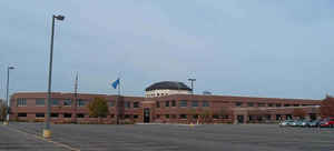
The County Seat is located in Elk River
Sherburne County is located in central Minnesota, between the Twin Cities and St Cloud. Originally the area was contested middle ground between the northern Minnesota Ojibwa people and the southern Minnesota Dakotas. A treaty in 1837 opened the area to whites and created a buffer zone between the tribes. After the treaty, ox cart trains moved goods and people through the area, but by the 1860s there were several small communities supporting the farmers who had settled. They were drawn by the available prairie land and the proximity to the Mississippi River, which is Sherburne County' southern border.
Geography: Land and Water
As reported by the Census Bureau, the county has a total area of 451 square miles (1,170 km2), of which 433 square miles (1,120 km2) is land and 18 square miles (47 km2) (4.0%) is water.
Neighboring Counties
Bordering counties are as follows:
- Mille Lacs County (north)
- Isanti County (northeast)
- Anoka County (southeast)
- Wright County (southwest)
- Stearns County (west)
- Benton County (northwest)
Education


Click Image to Enlarge
