


Click Image to Enlarge
Montana Counties
There are fifty-six counties in Montana. Montana has two consolidated city-counties- Anaconda with Deer Lodge County and Butte with Silver Bow County. The portion of Yellowstone National Park that lies within Montana was not part of any county until 1997, when part of it was nominally added to Gallatin County, and the rest of it to Park County.Carbon County, Montana
Carbon County Education, Geography, and History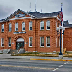
Carbon County is a county located in the state of Montana. Based on the 2010 census, the population was 10,078. Its county seat is Red
Lodge.
Carbon County is part of the Billings, MT Metropolitan Statistical Area.
Etymology - Origin of Carbon County Name
Coal deposits in the area
Demographics:
County QuickFacts: CensusBureau Quick Facts
Carbon County History
Carbon County is located in south central Montana. Carbon County was created on March 4, 1895 from portions of Park
and Yellowstone counties and includes an area of 2,066 square miles. The county seat is located in Red Lodge; other
towns located within Carbon County include Bearcreek, Belfry, Bridger, Fromberg, Edgar, Silesia, Joliet, Boyd, Roberts,
Luther and Roscoe. To the south and west lie the picturesque Beartooth Mountains whose lofty peaks include Montana's
highest, Granite Peak with an elevation of 12,799 feet. Flowing from the mountains, the Clark's Fork of the Yellowstone
River meanders through central portions of the county. On the eastern edge of the county are the Pryor Mountains and the
Big Horn River. Coal deposits were originally discovered in the Red Lodge area, those portions were ceded from the Crow
Indian Reservation to allow for development. The Rocky Fork Railroad was constructed to access those coal deposits. As
the Crow Indian Reservation diminished settlers moved in to acquire 160 acre homesteads. Settlers arrived from such
diverse locations as England, Scotland, Ireland, Germany, Scandinavia, Finland, Austria, Yugoslavia, Italy and Russia.
Many of those early residents worked in the coal mines in the area, the largest of which were located between Red Lodge
and Bearcreek. Oil and gas were also discovered in Carbon County with two abundant fields, the Dry Creek Field and the
Elk Basin Fields. As the demand for coal dwindled, agriculture became a mainstay in the region, with cattle and hay
primarily in the mountain areas and foothills, while more cropland opportunities lay in the Clark's Fork Valley.
Geography: Land and Water
As reported by the Census Bureau, the county has a total area of 2,062 square miles (5,341 km2), of which,
2,048 square miles (5,304 km2) of it is land and 14 square miles (37 km2) of it (0.69%) is water.
Neighboring Counties
Bordering counties are as follows:
- Park County, Montana - west
- Stillwater County, Montana - north
- Yellowstone County, Montana - northeast
- Big Horn County, Montana - east
- Big Horn County, Wyoming - southeast
- Park County, Wyoming - south
Education


Click Image to Enlarge
