


Click Image to Enlarge
Montana Counties
There are fifty-six counties in Montana. Montana has two consolidated city-counties- Anaconda with Deer Lodge County and Butte with Silver Bow County. The portion of Yellowstone National Park that lies within Montana was not part of any county until 1997, when part of it was nominally added to Gallatin County, and the rest of it to Park County.Cascade County, Montana
Cascade County Education, Geography, and History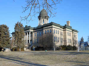
Cascade County (cascade means waterfall in French) is a county located in the state of Montana. Based on the 2010 census, the population
was 81,327,[ making it the fifth-most populous county in Montana. Its county seat is Great Falls.
Cascade County comprises the Great Falls, MT Metropolitan Statistical Area.
Etymology - Origin of Cascade County Name
The Great Falls of the Missouri River
Demographics:
County QuickFacts: CensusBureau Quick Facts
Cascade County History
Cascade County was created 12 September 1887 from Chouteau, Meagher, and Lewis and Clark Counties. County seat: Great Falls
On September 12, 1887, "An Act Creating Cascade County, its Boundaries, provisions for its organization and the
officers to fill the various positions until the first election," was passed by the Territorial Legislative
Assembly. Cascade County had been formed from parts of Meagher, Choteau and Lewis and Clarke* Counties. Great Falls
was designated as the County Seat until otherwise determined by law. Included in the Act were portions of debts
incurred by the original counties that would be paid by Cascade County,money transfers from county treasurers to be
paid to the Cascade County Treasurer for the support of schools in the new county, provisions for the election of
county officials, and the powers and duties of the officials.
*As was spelled in the 1887 Montana Code Book.
Geography: Land and Water
As reported by the Census Bureau, the county has a total area of 7,023 km2 (2,712 sq mi). 6,988 km2 (2,698 sq
mi) of it is land and 36 km2 (14 sq mi) of it (0.51%) is water.
Neighboring Counties
Bordering counties are as follows:
- Teton County, Montana - north
- Chouteau County, Montana - north
- Judith Basin County, Montana - east
- Meagher County, Montana - south
- Lewis and Clark County, Montana - west
Education
The University of Great Falls and the MSU College of Technology - Great Falls are both located in Great Falls


Click Image to Enlarge
