


Click Image to Enlarge
Montana Counties
There are fifty-six counties in Montana. Montana has two consolidated city-counties- Anaconda with Deer Lodge County and Butte with Silver Bow County. The portion of Yellowstone National Park that lies within Montana was not part of any county until 1997, when part of it was nominally added to Gallatin County, and the rest of it to Park County.Chouteau County, Montana
Chouteau County Education, Geography, and History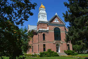
Chouteau County is a county located in the North-Central region of the state of Montana. Based on the 2010 census, the population was 5,813. Its county seat is Fort Benton. The county was established in 1865 as one of the original nine counties of Montana, and named in 1882 after Pierre Chouteau, Jr., a fur trader who established a trading post that became Fort Benton, which was once an important port on the Missouri River.
Etymology - Origin of Chouteau County Name
Jean Pierre Chouteau and his son Pierre Chouteau, Jr., of the Chouteau fur-trading family
Demographics:
County QuickFacts: CensusBureau Quick Facts
Chouteau County History
Chouteau County was created 2 February 1865 as an original county. County seat: Fort Benton
Chouteau County is located in North Central Montana, about 100 miles south of the Canadian border. Established in 1865, it is one of the original nine counties of the Montana Territory. It was named in 1882 for Auguste & Pierre Chouteau, fur traders and owners of the original trading post Historic Old Fort Benton, from which the community of Fort Benton, today's county seat, took its name. Fort Benton, named for Senator Thomas H. Benton of Missouri, was once an important port on the Missouri River. Fur traders, gold seekers, and settlers came via steamboats to Fort Benton, the "Head of Navigation" on the Missouri River. Today, Fort Benton still retains much of its "steamboat days" character. Fort Benton, Big Sandy & Geraldine are the population centers with smaller communities in Loma, Carter, Floweree, Highwood, Shonkin, and Square Butte.
Chouteau County was once the largest county in the Montana Territory and the second largest in the United States.
Chouteau County was subdivided repeatedly to form other counties until it reached its present size, an area of 3936
square miles and a population of 5,738. It is home to the Chippewa-Cree tribe on the Rocky Boys Indian reservation
in the Bear's Paw Mountains to the northeast, and contains part of the Lewis and Clark National Forest in the
Highwood Mountains to the south. The terrain is primarily gently rolling plains that are dissected in the central
portion by the eastward flowing Missouri River. The land is a complex of uplands, valleys, coulees, and broad
plains. The primary surface water sources are the Missouri, Marias, and Teton Rivers. Streams of secondary
importance are Highwood, Shonkin, Big Sandy and Arrow Creek.
Geography: Land and Water
As reported by the Census Bureau, the county has a total area of 3,997 square miles (10,352 km2). 3,973 square
miles (10,291 km2) of it is land and 24 square miles (62 km2) of it (0.59%) is water.
Chouteau County was once the largest county in the Montana Territory and the second largest in the United States,
with an area of 15,439 square miles in the early 20th century. However, some parts of the county were over 250 miles
from Fort Benton, and in 1909 an agreement was reached to subdivide the county.
Chouteau County lost half of its population from 1910 to 1930.
The land is mostly prairie. The Bear Paw Mountains rise in the eastern section and the Little Rockies and the
Highwood ranges are in the southern portion. Major rivers include the Teton River, Marias River, Milk River and the
Arrow River.
Neighboring Counties
Bordering counties are as follows:
- Liberty County, Montana - north
- Hill County, Montana - north
- Blaine County, Montana - east
- Fergus County, Montana - southeast
- Judith Basin County, Montana - south
- Cascade County, Montana - south
- Teton County, Montana - west
- Pondera County, Montana - northwest
Education


Click Image to Enlarge
