


Click Image to Enlarge
Montana Counties
There are fifty-six counties in Montana. Montana has two consolidated city-counties- Anaconda with Deer Lodge County and Butte with Silver Bow County. The portion of Yellowstone National Park that lies within Montana was not part of any county until 1997, when part of it was nominally added to Gallatin County, and the rest of it to Park County.Gallatin County, Montana
Gallatin County Education, Geography, and History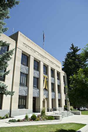
Gallatin County is a county located in the state of Montana. Based on the 2010 census, the population was 89,513, making it the
fourth-most populous county in Montana. Its county seat is Bozeman, home of Montana State University. The county was founded in 1865.
Gallatin County comprises the Bozeman, MT Micropolitan Statistical Area.
Etymology - Origin of Flathead County Name
Albert Gallatin, the United States Secretary of the Treasury at the time of the Lewis and Clark Expedition
Demographics:
County QuickFacts: CensusBureau Quick Facts
Flathead County History
Gallatin County was created 2 February 1865 as an original county. County seat: Bozeman
Gallatin County, Montana, derives its name from the Gallatin River, one of the forks of the Missouri River that rises
in Yellowstone Park, the three rivers, Gallatin, Jefferson and Madison, being named by Lewis and Clark, famous
explorers, on their expedition to this part of the world in 1805. The Gallatin River was named for Albert Gallatin, at
that time secretary of the United States Treasury under President Thomas Jefferson. Albert Gallatin was a native of
Switzerland. He was graduated from the Academy of Geneva in 1778, and came the following year to the United States,
where he became a great American statesman and one of the foremost financiers of the country. The Gallatin River has its
source in Gallatin Lake among mountain peaks with an elevation of more than 9,000 feet in Yellowstone National Park.
The other rivers uniting with the Gallatin to form the Missouri River, a few miles from the present town of Three Forks,
are the Jefferson, named in honor of Thomas Jefferson, then president of the United States, and the Madison, named in
honor of James Madison, then Secretary of State. It was in July 1805, that Lewis and Clark reached the three forks of
the Missouri, and they spent considerable time in exploring the three streams and the territory immediately tributary.
These streams have retained the names designated at that time.
Entries in the journal of Lewis and Clark under date of July 28, 1805, tell of their naming these three branches of the
Missouri River as mentioned, and their description says: "The Jefferson and Madison, as well as the Gallatin River, run
with great velocity and throw out large bodies of water. Gallatin River, however, is the most rapid of the three, and
though not quite as deep, is yet navigable for a considerable distance. Madison River, though much less rapid than the
Gallatin, is somewhat more rapid than the Jefferson; the beds of all of them are formed of smooth pebble and gravel, and
the waters are perfectly transparent."
The county attained its present boundaries on November 7, 1997, when the former Yellowstone National Park (part) county-equivalent was dissolved and apportioned between Gallatin County and Park County. Gallatin County received 99.155 square miles (256.81 km2) of land area and 0.119 square miles (0.309 km2) of water area, whereas Park County received 146.229 square miles (378.73 km2) of land area and 0.608 square miles (1.575 km2) of water area. The geographies transferred are known now as Census Tract 14 in Gallatin County, and as Census Tract 6 in Park County.
Geography: Land and Water
As reported by the Census Bureau, the county has a total area of 2,632 square miles (6,816 km2), of which, 2,606 square miles (6,749 km2) of it is land and 26 square miles (67 km2) of it (0.99%) is water.
The prominent physical feature of the county is the Gallatin River, named by Meriwether Lewis in 1805 for Albert Gallatin, US Treasury
Secretary from 1801-14. A small part of Yellowstone National Park lies in the southeastern portion of the county. The Big Sky Resort is about
midway between West Yellowstone and Bozeman, though the ski area itself lies mostly in neighboring Madison County, Montana. The Gallatin River
canyon is accessed by US Highway 191. In the mid-19th century, a portion of Gallatin County was left over after the division of the Dakota
Territory into other states. In 1873, the patch was attached to Montana and became part of Gallatin County.
Neighboring Counties
Bordering counties are as follows:
- Madison County, Montana - west
- Jefferson County, Montana - northwest
- Broadwater County, Montana - north
- Meagher County, Montana - northeast
- Park County, Montana - east
- Park County, Wyoming - southeast
- Teton County, Wyoming - southeast
- Fremont County, Idaho - southwest
Education


Click Image to Enlarge
