


Click Image to Enlarge
New York Counties
There are sixty-two counties in the State of New York. The first twelve counties in New York were created immediately after the British annexation of the Dutch colony of New Amsterdam, although two of these counties have since been abolished. The most recent county formation in New York was in 1912, when Bronx County was created from the portions of New York City that had been annexed from Westchester County.Broome County, New York
Broome County Education, Geography, and History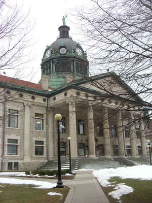
Broome County is a county located in the state of New York. Based on the 2010 census, the population was 200,600. Its county seat and
largest city is Binghamton. The county was named in honor of John Broome, who was lieutenant governor in 1806 when Broome County was
established.
Broome County is part of the Binghamton, NY Metropolitan Statistical Area.
Etymology - Origin of Broome County Name
Named in honor of Joseph Bronck, first settler of the region north of the Harlem River (a peace treaty with the Indians was signed at his home in 1642)
Demographics:
County QuickFacts: CensusBureau Quick Facts
Broome County History
Broome County, named after Lieut. Gov. Broome, was taken from Tioga in 1806. Length on the Pennsylvania line, 37
miles; breadth on the Tioga boundary 28, on the Delaware 13, and midway 17 miles. Centrally distant from New York,
northwest 252, and from Albany, southwest, 145 miles. The surface of the country is broken and mountainous. Among its
principal elevations are the Cookquago, the Oquago, and the Randolph mountains. The valleys bordering on its numerous
streams are extensive and fertile, producing large quantities of wheat. The soil is generally better adapted to grazing
than the culture of grain. Fruit succeeds well. The inhabitants are principally farmers, and it's agriculture is
respectable. The Chenango canal enters the county on the north, follows down the vally of the Chenango river, and enters
the Susquehannnah river at Binghamtion. The line of the Erie railroad passes throught he county. The county is divided
into 11 towns. (Historical Collections of the State of New York, Past and Present, Barber, John, Warner, Clark Albien &
Co. 1851)
Broome County is defined by the valleys and hills surrounding the confluence of the Susquehanna and Chenango Rivers and the rich
contrast between urban living in the Greater Binghamton area and the surrounding rural environment.
Native Americans inhabited this area until the end of the American Revolution. Two main settlements were Onaquaga, near present-day Windsor, and
Otseningo, located along the Chenango River, north of present-day Binghamton. Part of the Iroquois Confederacy, it was considered a threat to the
revolutionists. The Sullivan-Clinton campaign removed the Native American population. After the Revolution, land was divided among many land
speculators, including William Bingham, who obtained over ten thousand acres at the confluence of the Susquehanna and Chenango Rivers.
Geography: Land and Water
Broome County is located in south-central New York State, directly north of the border with Pennsylvania in a
section of the state called the Southern Tier. The Chenango River joins the Susquehanna River, which flows through
the county.
The western half of the county is hilly but has wide valleys that accommodate Binghamton and its suburbs. In the
northern portion Interstate 81 takes advantage of another glacial valley. To the east, however, the terrain becomes
much more rugged as the land tilts up to the Catskills.
The highest elevation is a US National Geodetic Survey benchmark known as Slawson atop an unnamed hill in the Town
of Sanford. It is approximately 2,080 feet (634 m) above sea level. An area due east on the Delaware County line in
Oquaga Creek State Park also lies within the same elevation contour line. The lowest point is 864 feet (263 m) above
sea level, along the Susquehanna at the Pennsylvania state line.
As reported by the Census Bureau, the county has a total area of 715 square miles (1,853 km2), of which, 707
square miles (1,831 km2) of it is land and 9 square miles (22 km2) of it (1.21%) is water.
Neighboring Counties
Bordering counties are as follows:
- Chenango County, New York - north
- Delaware County, New York - east
- Wayne County, Pennsylvania - southeast
- Susquehanna County, Pennsylvania - south
- Tioga County, New York - west
- Cortland County, New York - northwest
Education
The four primary institutes of higher education in Broome County include:
Binghamton University With a student population of 16,000, it is responsible for a large portion of the population in and around Broome's
largest city, Binghamton, New York.
Broome Community College, also known as BCC. The school serves as a two-year associate-granting institution for local residents.
Davis College, a small, private, Christian college in Johnson City, New York.
Ridley-Lowell Business and Technical Institute, Ridley-Lowell is a career technical institute that offers career training programs.


Click Image to Enlarge
