


Click Image to Enlarge
New York Counties
There are sixty-two counties in the State of New York. The first twelve counties in New York were created immediately after the British annexation of the Dutch colony of New Amsterdam, although two of these counties have since been abolished. The most recent county formation in New York was in 1912, when Bronx County was created from the portions of New York City that had been annexed from Westchester County.Chautauqua County, New York
Chautauqua County Education, Geography, and History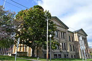
Chautauqua County is the westernmost county in the state of New York. Based on the 2010 census, the population was 134,905. Its county
seat is Mayville, and its largest city is Jamestown. Its name may be a contraction of a Seneca Indian word meaning "bag tied in the middle".
The county was created in 1808 and later organized in 1811.
Chautauqua County comprises the Jamestown-Dunkirk-Fredonia, NY Micropolitan Statistical Area. It is located south of Lake Erie and includes
part of the Cattaraugus Reservation of the Seneca.
Etymology - Origin of Chautauqua County Name
A contraction of a Seneca Indian word meaning "where the fish was taken out"
Demographics:
County QuickFacts: CensusBureau Quick Facts
Chautauqua County History
Chautauqua County was created by partition of Genesee County on 1808-03-11. This partition was performed under
the same terms that produced Cattaraugus and Niagara Counties. The partition was performed for political purposes,
but the counties were not properly organized, so they were all controlled as part of Niagara County.
On February 9, 1811, Chautauqua was completely organized, and so its separate government was launched. This
established Chautauqua as a county of 1,100 Square Miles (2,848.99 Square KM) of land. Chautauqua was never altered.
Chautauqua County, the western gateway to New York State, occupies the extreme southwest corner of our state. With its two cities, Jamestown and Dunkirk, its twenty-seven towns and fifteen villages, it covers 1,065 square miles of Lake Erie shoreline, there is no place in the county more than twenty-five miles from open water.
Geography: Land and Water
Chautauqua County, in the southwestern corner of New York State, along the New York-Pennsylvania border, is the
westernmost of New York's counties. Chautauqua Lake is located in the center of the county, and Lake Erie is its
northern border.
Part of the Eastern Continental Divide runs through Chautauqua County. The area that drains into the Conewango Creek
(including Chautauqua Lake) eventually empties into the Gulf of Mexico; the rest of the county's watershed empties
into Lake Erie and out into the North Atlantic Ocean. This divide can be used to mark the border between the
Southern Tier and the Niagara Frontier.
As reported by the Census Bureau, the county has a total area of 1,500 square miles (3,885 km2). 1,062 square
miles (2,751 km2) of it is land and 438 square miles (1,134 km2) of it (29.20%) is water.
Neighboring Counties
Bordering counties are as follows:
- Lake Erie - northwest
- Erie County, New York - northeast
- Cattaraugus County, New York - east
- Warren County, Pennsylvania - southeast
- Erie County, Pennsylvania - southwest
Education
Jamestown Community College has two campuses in the county at Jamestown and Dunkirk. The State University of New York at Fredonia is located in the northern part of the county. Jamestown Business College offers two year degrees, certificates, and a four-year degree in Jamestown.


Click Image to Enlarge
