


Click Image to Enlarge
New York Counties
There are sixty-two counties in the State of New York. The first twelve counties in New York were created immediately after the British annexation of the Dutch colony of New Amsterdam, although two of these counties have since been abolished. The most recent county formation in New York was in 1912, when Bronx County was created from the portions of New York City that had been annexed from Westchester County.Cortland County, New York
Cortland County Education, Geography, and History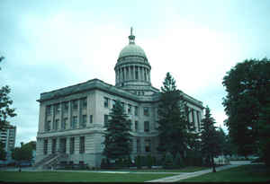
Cortland County is a county located in the state of New York. Based on the 2010 census, the population of Cortland County was 49,336. The
county seat is Cortland. The county is named after Pierre Van Cortlandt, president of the convention at Kingston that wrote the first New York
State Constitution in 1777, and first lieutenant governor of the state.
Cortland County comprises the Cortland, NY Micropolitan Statistical Area, which is also included in the Ithaca-Cortland, NY Combined
Statistical Area.
The Cortland apple is named for the county.
Etymology - Origin of Cortland County Name
Named in honor of Pierre Van Cortlandt, who was the first lieutenant governor of the state (in 1777 he was president of the convention at Kingston that framed the state's first constitution)
Demographics:
County QuickFacts: CensusBureau Quick Facts
Cortland County History
Located in the glaciated Appalachian Plateau area of Central New York State, midway between Syracuse and Binghamton,
this predominantly rural county is the southeastern gateway to the Finger Lakes Region. Scattered archaeological
evidence indicates three different aboriginal cultures hunted the area beginning about 1500 A. D.
What was to become Cortland County remained within Indian territory until the American Revolution. It became part of the
Military Tract, when, in 1781, more than 1? million acres (5,100 km2) were set aside by the State's Legislature to
compensate two regiments formed to protect the State's western section from the English and their Iroquois allies, at
the close of the Revolution. To encourage settlement in the upstate isolated wilderness, the State constructed a road
from Oxford through Cortland County to Cayuga Lake in 1792-94. This, and construction of privately financed roads, were
the major impetus to settlement.
When counties were established in New York State in 1683, the present Cortland County was part of Albany County. This
was an enormous county, including the northern part of New York State as well as all of the present State of Vermont
and, in theory, extending westward to the Pacific Ocean. This county was reduced in size on July 3, 1766 by the creation
of Cumberland County, and further on March 16, 1770 by the creation of Gloucester County, both containing territory now
in Vermont.
On March 12, 1772, what was left of Albany County was split into three parts, one remaining under the name Albany
County. One of the other pieces, Tryon County, contained the western portion (and thus, since no western boundary was
specified, theoretically still extended west to the Pacific). The eastern boundary of Tryon County was approximately
five miles west of the present city of Schenectady, and the county included the western part of the Adirondack Mountains
and the area west of the West Branch of the Delaware River. The area then designated as Tryon County now includes 37
counties of New York State. The county was named for William Tryon, colonial governor of New York.
In the years prior to 1776, most of the Loyalists in Tryon County fled to Canada. In 1784, following the peace treaty
that ended the American Revolutionary War, the name of Tryon County was changed to honor the general, Richard
Montgomery, who had captured several places in Canada and died attempting to capture the city of Quebec, replacing the
name of the hated British governor. Montgomery County was reduced in size in 1789 by the splitting off of Ontario
County. The actual area split off from Montgomery County was much larger than the present county, also including the
present Allegany, Cattaraugus, Chautauqua, Erie, Genesee, Livingston, Monroe, Niagara, Orleans, Steuben, Wyoming, Yates,
and part of Schuyler and Wayne Counties.
In 1791, Herkimer County was one of three counties split off from Montgomery (the others being Otsego, and Tioga
Counties).
Onondaga County was formed from Herkimer County in 1794.
Cortland County was formed by the splitting of Onondaga County in 1808.
Cortland County is located in the glaciated Appalachian Plateau area of central New York midway between Syracuse and Binghamton. This predominately rural county is the southeastern gateway to the Finger Lakes region. Scattered archeological evidence indicates occupation of this area by three different aboriginal cultures, mainly the Onondaga Tribe of the Iroquois Confederacy beginning about 1500 A.D.
Geography: Land and Water
Cortland County is somewhat to the west of the center of New York State, south of Syracuse and north of
Binghamton.
As reported by the Census Bureau, the county has a total area of 502 square miles (1,299 km2), of which, 500
square miles (1,294 km2) of it is land and 2 square miles (5 km2) of it (0.37%) is water.
Neighboring Counties
Bordering counties are as follows:
- Onondaga County, New York - north
- Madison County, New York - northeast
- Chenango County, New York - east
- Broome County, New York - southeast
- Tompkins County, New York - southwest
- Tioga County, New York - southwest
- Cayuga County, New York - northwest
Education
State University of New York at Cortland
Tompkins Cortland Community College
Cincinnatus Central School District
Cortland City School District
Homer Central School District
Marathon Central School District
McGraw Central School District


Click Image to Enlarge
