


Click Image to Enlarge
New York Counties
There are sixty-two counties in the State of New York. The first twelve counties in New York were created immediately after the British annexation of the Dutch colony of New Amsterdam, although two of these counties have since been abolished. The most recent county formation in New York was in 1912, when Bronx County was created from the portions of New York City that had been annexed from Westchester County.Lewis County, New York
Lewis County Education, Geography, and History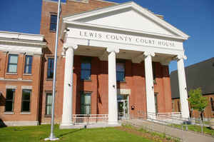
Lewis County is a county located in the state of New York. Based on the 2010 census, the population was 27,087, making it the fourth-least populous county in New York. Its county seat is Lowville. The county is named after Morgan Lewis, the Governor of New York when the county was established
Etymology - Origin of Lewis County Name
Named in honor of Morgan Lewis, governor of New York from 1804 to 1807
Demographics:
County QuickFacts: CensusBureau Quick Facts
Lewis County History
Lewis County, was taken from Oneida in 1805, and named in honor of Governor Morgan Lewis. Centrally distant NW. from
New York 275, and from Albany 130 miles. Greatest length N. and S. 54; greatest breadth E. and W. 35 miles. The whole of
this county was included in the patent from the state to Alexander Macomb, and was sold by him to William Constable, and
by the latter in parcels: the portion ~vest of the Black river, to capitalists in New York city, among whom Nicholas
Low, Richard Harrison, and Josiah Ogden Hoffman, were principal purchasers; and the portion on the east of the Black
river, to a French company in Paris. From these sources the present possessors derived their title. The first
settlements commenced here in 1795, by pioneers from Massachusetts and Connecticut, who, with characteristic enterprise
and perseverance, entered the wilderness with a determination to surmount the most formidable obstacles. There were at
this time small settlements at Utica and Fort Stanwix, (now Rome,) whence the settlers made their way into this county,
by a line of marked trees, to the High Falls, on Black river; and thence floated with the stream to the town of
Lowville, where they established themselves. Their families followed in the succeeding winter, shod with snow shoes;
mothers making their way with infants in their arms, whilst their husbands and fathers trod paths through the snow for
their cattle and teams. It was not unusual, some time after, for farmers to go forty miles to mill, and to carry the
grist upon their shoulders.
The Black river divides the county into two not very unequal portions. Upon this river are broad alluvial flats, of easy cultivation and
highly productive. Of the Black river we may observe here, that below the High Falls at Leyden, which are 63 feet in altitude, it has a
tranquil course of nearly 40 miles through the country; in all which it is navigable for steamboats. The Black river canal, the construction of which was authorized in May, 1836, commences at Rome in
Oneidacounty. The county is at present thinly inhabited, but it merits attention from the great forests of useful timber
which encumber the soil, the beds of iron ore which lie beneath it, and the vast water-power which the streams supply.
The staple products are wheat, rye, Indian corn, peas, beans, oats, and barley, and the whole country is adapted to
grass. It is divided into 12 towns. (Historical Collections of the State of New York, Past and Present, John Barber,
Clark Abien & Co., 1851)
By an act of the New York State Legislature on March 28, 1805, Lewis and Jefferson Counties were created, being sectioned off from Oneida County of which they had both been a part. The name Lewis was chosen in honor of Morgan Lewis, a son of Francis Lewis (who was among the New York signers of the Declaration of Independence). Morgan Lewis had actively served in Washington's army throughout the war, assigned at different times to General Gates and Clinton. At the time Lewis County was formed, Morgan Lewis was then serving as Governor of New York State.
Geography: Land and Water
Lewis County is located in northwestern New York State, slightly east of due north from Syracuse. The eastern
part of the county is in the Adirondack Park. A good portion of the Tug Hill Plateau is in the western part of the
county. The county is home to the Black River Valley.
As reported by the Census Bureau, the county has a total area of 1,290 square miles (3,341 km2), of which, 1,275
square miles (3,303 km2) of it is land and 14 square miles (37 km2) of it (1.12%) is water.
Neighboring Counties
Bordering counties are as follows:
- St. Lawrence County, New York - north
- Herkimer County, New York - east
- Oneida County, New York - south
- Oswego County, New York - west
- Jefferson County, New York - northwest
Education


Click Image to Enlarge
