


Click Image to Enlarge
New York Counties
There are sixty-two counties in the State of New York. The first twelve counties in New York were created immediately after the British annexation of the Dutch colony of New Amsterdam, although two of these counties have since been abolished. The most recent county formation in New York was in 1912, when Bronx County was created from the portions of New York City that had been annexed from Westchester County.Oneida County, New York
Oneida County Education, Geography, and History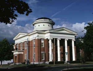
Oneida County is a county located in the state of New York. Based on the 2010 census, the population was 234,878. The county seat is
Utica. The name is in honor of the Oneida, an Iroquoian tribe that had this territory at the time of European encounter and has a reservation
in the region.
Oneida County is part of the Utica-Rome, NY Metropolitan Statistical Area.
Etymology - Origin of Oneida County Name
Named in honor of an Indian tribe of the Iroquois League
Demographics:
County QuickFacts: CensusBureau Quick Facts
Oneida County History
Oneida County is located in central New York State. It was formed from Herkimer County by an act of the Legislature
on March 15, 1798. The boundaries of the county were described as follows:
" All that part of Herkimer County beginning at the south-west corner of the town of Bridgewater, and running thence
easterly on the line of said town to the Unadilla River, thence northerly and easterly on the line of Bridgewater to the
town of Litchfield, thence northerly on the line of Bridgewater and Litchfield to the southeast corner of the town of
Paris, thence the same line continued on the the eastern line of Paris and Whitestown to the southerly line of Cosby's
Manor, thence north-easterly in a direct line to the northerly bounds of said Cosby's Manor, at a point where the same
is intersected by the division line between Gage's and Walton's Patents, thence notherly on the line between the said
Walton's and Gage's Patents to the West Canada Creek, thence northerly up the waters of said creek to the forks thereof,
thence easterly up the east branch of said creek to the north-east corner of Service's Patent, thence northerly to the
northern bounds of this State, thence westerly along the northern of this State to Lake Ontario, thence along the
easterly shore of said lake to the mouth of the Oswego River, thence easterly up said river to the Oneida Lake, thence
along the southern side of said lake to the Oneida Creek, thence up said creek on the eastern line of the County of
Chenango to the northern line of the town of Hamilton, thence easterly along the northern bounds of said towns of
Hamilton adn Sangerfield to the north-western corner of the town of Bridgewater, thence southerly on the western line of
said town of Bridgewater to the place of the beginning"
Situated in the geographical center of New York State, Oneida County us a county of contrasts. Comprised of productive farmland, and forested areas, and of industrialized urban areas and suburban communities. The principal geographical feature, the Mohawk River Valley, bisects the county in an east-west direction. It was through this historic valley that early Native American trails, trappers' routes and early military routes were located. When permanent settlement by the Europeans began, the Mohawk River Valley was a primary route of westward travel.
Geography: Land and Water
Oneida County is in the central portion of New York State, east of Syracuse, and west of Albany. Oneida Lake is
on the northwestern corner of the county, and the Adirondack Park is on the northeast. Part of the Tug Hill Plateau
is in the northern part of the county. Interestingly, Oneida County's highest point does lies neither on the plateau
nor in the Adirondack Park, but in the county's southern extremity. The peak's name is Tassel Hill. It is located
slightly southeast of Hardscrabble Road (Tassel Hill Road), between the villages of Waterville and Cassville.
The Erie Canal bisects the county. Oneida Lake and Oneida Creek form part of the western boundary.
As reported by the Census Bureau, the county has a total area of 1,257 square miles (3,256 km2), of which, 1,213
square miles (3,141 km2) of it is land and 44 square miles (115 km2) of it (3.53%) is water.
Neighboring Counties
Bordering counties are as follows:
- Lewis County, New York - north
- Herkimer County, New York - east
- Otsego County, New York - southeast
- Madison County, New York - southwest
- Oswego County, New York - west
Education
Hamilton College
Mohawk Valley Community College
State University of New York Polytechnic Institute
Utica College


Click Image to Enlarge
