


Click Image to Enlarge
New York Counties
There are sixty-two counties in the State of New York. The first twelve counties in New York were created immediately after the British annexation of the Dutch colony of New Amsterdam, although two of these counties have since been abolished. The most recent county formation in New York was in 1912, when Bronx County was created from the portions of New York City that had been annexed from Westchester County.Schoharie County, New York
Schoharie County Education, Geography, and History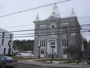
Schoharie County is a county located in the state of New York. Based on the 2010 census, the population was 32,749, making it the
fifth-least populous county in New York. The county seat is Schoharie. The name of the county and the county seat come from a Mohawk word
meaning "floating driftwood."
Schoharie County is part of the Albany-Schenectady-Troy, NY Metropolitan Statistical Area.
Etymology - Origin of Schoharie County Name
from the Mohawk Indian word meaning "floating driftwood"
Demographics:
County QuickFacts: CensusBureau Quick Facts
Schoharie County History
SCHOHARIE COUNTY was taken from Albany and Otsego counties in 1795; greatest length N. and S. 30, greatest breadth E.
and W. 25 miles. Centrally distant NW. from New York 150, from Albany W. 42 miles. In the western part of this county is
the dividing ridge between the waters of the Mohawk and those of the Susquehannah and Delaware. In the eastern part it
has the Catskill and Helleberg mountains. It has the valley of the Schoharie creek north and south through its centre,
along which the alluvial flats are very extensive, with a soil of loam and vegetable mould, peculiarly rich and fertile.
Much of the surface of this county is hilly, with some of a mountainous character. The soil of the uplands is of various
qualities, generally better adapted to grass than to grain. The Schoharie creek, a large tributary of the Mohawk, has
its rise in Greene county, and flows northward through the centre of this county. In its course it receives several
smaller streams, the principal of which are the Cobelskill on the west, and Fox creek on the east. The Catskill has its
source in the eastern part of the county, and the Delaware and Susquehannah in the western. The county is well watered,
and possesses many fine mill sites. In the towns of Summit, Jefferson, Blenheim, Broome, and the uplands of Middleburg
and Fulton, the tenure of the soil is generally held by lease, the fee-simple being in proprietors of large tracts; but
in these towns, there are many tracts upon the creek, which the Germans have taken up in fee, the common tenure of the
northern towns. The towns of Schoharie, Cobelskill, Sharon, Fulton, Middleburg, and portions of Blenheim and Broome,
have a population of German origin.
The German language prevails among the older inhabitants, but their children are educated and converse in English. The
early settlers suffered much from Indian hostilities, and during the revolution the country was overrun by the British
and Indians under Sir John Johnson, Brant, and the infamous Walter Butler. The county is divided into 12 towns.
(Historical Collections of the State of New York, Past and Present, John Barber, Clark Albien & Co., 1851)
What is now known as Schoharie County was organized as a town in Albany County in 1788, governed from Albany with no representation from Schoharie. This situation was not entirely satisfactory to the inhabitants of the region, and many petitions were sent to the Albany Legislature urging them to set Schoharie Town up as a separate county. About 1795, George Tiffany and Jacob Gebhard, of Schoharie Village, Jonathan Danforth of Middleburgh, William Beekman, John Rice and Calvin Rich of Seward and Sharon, petitioned the State Legislature for the formation of a separate county. Their request was granted on April 6, 1795.
Geography: Land and Water
Schoharie County is in central New York State, west of Albany and southeast of Utica.
As reported by the Census Bureau, the county has a total area of 626 square miles (1,622 km2), of which, 622
square miles (1,611 km2) of it is land and 4 square miles (11 km2) of it (0.69%) is water.
Much of the southern portion of the county lies within the Catskill Mountains. Land rises in both directions quite
rapidly from Schoharie Creek in the middle of the county. The Schoharie Creek is a northward-flowing tributary of
the Mohawk River. The Schoharie Creek watershed spans an area of approximately 950 square miles. The course of
Schoharie Creek includes two reservoir-dam systems. The Gilboa Dam and the Schoharie Reservoir are part of the New
York City Water Supply System. The New York Power Authority operates the Blenheim-Gilboa Dam and its reservoir to
produce hydroelectric power.
The highest point is found at the summit of Huntersfield Mountain on the southern boundary with Greene County, 3,423
feet (1,043 m) above sea level. The lowest point is where the Montgomery County line meets Schoharie Creek, 520 feet
(158 m) above sea level. The most prominent geological feature is Vroman's Nose, in the town of Middleburgh.
Neighboring Counties
Bordering counties are as follows:
- Montgomery County - north
- Schenectady County - northeast
- Albany County - east
- Greene County - southeast
- Delaware County - southwest
- Otsego County - west
Education


Click Image to Enlarge
