


Click Image to Enlarge
New York Counties
There are sixty-two counties in the State of New York. The first twelve counties in New York were created immediately after the British annexation of the Dutch colony of New Amsterdam, although two of these counties have since been abolished. The most recent county formation in New York was in 1912, when Bronx County was created from the portions of New York City that had been annexed from Westchester County.Schuyler County, New York
Schuyler County Education, Geography, and History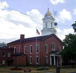
Schuyler County is a county located in the state of New York. Based on the 2010 census, the population was 18,343, making it the second-least populous county in New York. The county seat is Watkins Glen. The name is in honor of General Philip Schuyler, one of the four major generals in the Continental Army in the American Revolutionary War.
Etymology - Origin of Schoharie County Name
Named in honor of General Philip Schuyler, one of the four major generals of the Continental Army
Demographics:
County QuickFacts: CensusBureau Quick Facts
Schoharie County History
This county was formed from Steuben, Chemung, and Tompkins, April 17, 1854. It lies upon both sides of a S. extremity
of Seneca Lake; is centrally distant 160 mi. from Albany, and contains 352 sq. mi. Its surface is mostly an undulating
and hilly upland, divided into two distinct ridges by the deep valley of Seneca Lake and it's inlet. The highest summits
are 600 - 1,000 ft. above above Seneca Lake and 1,200 to 1,600 ft. above tide. A bluff 100 to 300 ft. high extends along
the shores of the lake, too steep for profitable cultivation; but farther inland the hills are bordered by long and
gradual slopes and are generally arable to their very summits. The extreme s. part of the co. assumes a more hilly and
broken character. Catherines Creek, flowing into the head of Seneca Lake, is the principal stream. Its course is through
a deep, narrow, and winding valley bordered by steep hillsides 400 to 600 ft. high. Upon it are numerous falls,
affording abundance of water-power; and near its mouth is a marshy region of considerable extent. Meads Creek, a
tributary of Chemung River, drains the SW corner, and Cayuta Creek is the SE corner.
Agriculture forms the leading and almost sole occupation of the people. Spring grains are extensively grown, and stock
and wool growing and dairying are largely carried on. The climate and soil are both better adapted to pasturage than to
tillage. Fruit is becoming an important article of culture, and all kinds adapted to the climate succeed well. A limited
amount of manufacturing is carried on at Watkins and Havana. (Gazetteer of the State of New York, 1860, J. H. French)
Schuyler County was named for Philip John Schuyler, a general in the French and Indian War and member of the Continental Congress. Schuyler's acreage is part of the Finger Lakes area preempted from the Iroquois Confederacy at the order of the new U. S. Government. Schuyler became a reality by state law in April 1854, an act effective January 1, 1855. At that time there were seven townships in the 342 square mile county.
Geography: Land and Water
Schuyler County is in the western part of New York State, west of Ithaca at the south end of Seneca Lake.
The Finger Lakes National Forest is in the north part of the county.
As reported by the Census Bureau, the county has a total area of 342 square miles (886 km2), of which, 329 square
miles (851 km2) of it is land and 14 square miles (35 km2) of it (3.95%) is water.
Neighboring Counties
Bordering counties are as follows:
- Seneca County, New York - north
- Tompkins County, New York - east
- Chemung County, New York - south
- Steuben County, New York - west
- Yates County, New York -
Education


Click Image to Enlarge
