


Click Image to Enlarge
New York Counties
There are sixty-two counties in the State of New York. The first twelve counties in New York were created immediately after the British annexation of the Dutch colony of New Amsterdam, although two of these counties have since been abolished. The most recent county formation in New York was in 1912, when Bronx County was created from the portions of New York City that had been annexed from Westchester County.Seneca County, New York
Seneca County Education, Geography, and History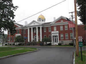
Seneca County is a county located in the state of New York. Based on the 2010 census, the population was 35,251. The primary county seat
is Waterloo, moved from the original county seat of Ovid in 1819. It became a two-shire county in 1822, using both locations as county seats
although the majority of Seneca County administrative offices are in Waterloo. Therefore, most political sources only list Waterloo as the
county seat. The county's name is from the Iroquois (Seneca) that occupied part of the region.
Seneca County comprises the Seneca Falls, NY Micropolitan Statistical Area, which is also included in the Rochester-Batavia-Seneca Falls, NY
Combined Statistical Area.
Etymology - Origin of Seneca County Name
from the Indian tribe that once occupied the region
Demographics:
County QuickFacts: CensusBureau Quick Facts
Seneca County History
Seneca County was taken from Cayuga in 1804; since which other counties have been formed from it. Its greatest length
N. and S. is 36 miles; medium width, 12. Centrally distant from New York, 317, from Albany, 172 miles. The land rises
gently from the Cayuga and Seneca lakes, and the whole county is pleasantly diversified with hills and vales. The soil
is well adapted to the culture of grain, grasses, and fruit trees, being principally a vegetable mould or calcareous
loam. There is no stream of importance excepting the outlet of the Seneca lake, which from Waterloo to Seneca lake
furnishes much hydraulic power. The lands of this county formed part of the military tract, and the titles therefore are
derived from the state through patents to the soldiers of the revolution. The Erie canal just touches upon the NE part,
in the town of Tyre. The railroad passes through the towns of Waterloo and Seneca Falls. The county is divided into 10
towns. (Historical Collections of the State of New York, Past and Present, John Barber, Clark Albien & Co., 1851)
Before the Revolutionary War, the area now covered by Seneca County was the home of the Cayuga and Seneca
Indians. The boundary line was between the village of Waterloo and Seneca Lake. The first in-depth historical data
on the area can be found in the journals of the men of the Sullivan-Clinton Expedition. The men entered the region
September 3, 1779. They traveled along the east shore of Seneca Lake to Canada-saga, now Geneva. Although no more
than 40 people died as a result of the expedition, the destruction of the Indian villages and farms was so complete
that it helped drastically to strengthen the position of the Americans at war.
Geography: Land and Water
As reported by the Census Bureau, the county has a total area of 391 square miles (1,011 km2), of which, 325
square miles (842 km2) of it is land and 66 square miles (170 km2) of it (16.80%) is water.
Seneca County is in the western part of New York State in the Finger Lakes Region, bounded on the east by Cayuga
Lake and on the west by Seneca Lake.
The Finger Lakes National Forest is in the south part of the county.
Both the New York State Thruway and the Erie Canal cross the northern part of the county.
The former Seneca Army Depot occupies a portion of land between Cayuga and Seneca Lakes. The Willard Drug Treatment
Center and Five Points Correctional Facility are two NYS DOCS prisons located in the county. Sampson State Park is
located next to the former Army base.
Neighboring Counties
Bordering counties are as follows:
- Cayuga County, New York - east
- Tompkins County, New York - southeast
- Schuyler County, New York - south
- Yates County, New York - west
- Ontario County, New York - west
- Wayne County, New York - northwest
Education


Click Image to Enlarge
