


Click Image to Enlarge
New York Counties
There are sixty-two counties in the State of New York. The first twelve counties in New York were created immediately after the British annexation of the Dutch colony of New Amsterdam, although two of these counties have since been abolished. The most recent county formation in New York was in 1912, when Bronx County was created from the portions of New York City that had been annexed from Westchester County.Sullivan County, New York
Sullivan County Education, Geography, and History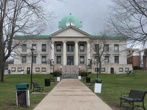
Sullivan County is a county located in the state of New York. Based on the 2010 census, the population was 77,547. The county seat is Monticello. The county's name is in honor of Major General John Sullivan, who was a hero in the American Revolutionary War.
Etymology - Origin of Sullivan County Name
Named in honor of Major General John Sullivan, Revolutionary hero and commander of an expedition against the Six Nations of Indians
Demographics:
County QuickFacts: CensusBureau Quick Facts
Sullivan County History
Early Long Island, it's Indians, Whaling and Folklore Rymes.
By: Paul Bailey
Long Island was discovered in the summer of 1524 by Giovanni Varrazano, a native of Florence, Italy. Employed by
Francis I of France to explore the New World. Verrazano, having sailed his ship, the Daphne across the Atlantic, skirted
the east coast of North America from below the Virginia to the west end of Long Island. There he was rowed through the
Narrows to New York's upper bay and the mouth of the Hudson River. Then returning to his ship, he skirted Long Island's
south shore to the vicinity to Block Island which he named the Island of Luisa. Landing on Montauk in the spring of
1614, Adrian Block became the first white man to tread the soil of future Suffolk County; also was the first to contact
its aboriginal inhabitants. It was he who, upon returning to Europe, first sold the idea the Paumanok, as the Indians
called the Island, was a very desirable piece of real estate and, like the immediate mainland, was well work any
government taking it over. This the Netherlands did, at the same time claming all the coastal territory from Canada,
where the French had already gained a foothold, to Virginia which had become British as early as 1607, as well as all
the wilderness streching west ward to a distance which was anybody's guess. For more than thirty years after Adrian
Block's Local expoloration, Long Island remaind all Indian. In 1639, the first two groups of New Englander's founded on
either side of the Island's east end. They were Southold, over looking the Sound, and Southampton, fronting upon the
Atlantic Ocean. Quite independent of one another, with the Peconic Bay laying deep between them. These two towns had
only one thing in common. Englishmen. The first nine family's of East Hampton were: John Hand, Thomas Talmag, JR.,
Daniel Howe, Thomas Thomson, John Stretten, SR., Robert Bond, Robert Rose, Joshua Barns, and John Mulford. They were
soon joined by Thomas Osborn, William Fithian, Richard Brooks, William Simonds, Samuel Belknap, Samuel Parson, Joshua
Garlick, Fulke Davis, Nathaniel Bishop, William Barnes, Stephen Hand, Thomas Baker, Richard Shaw, Jeremiah Meacham and
already settled on his Island estate, Lion Gardiner. In 1650, the line of division coincided almost identically with the
subsequent Nassau-Suffolk county line, and thus for the first time the Suffolk County area assumed a distint political
identity although, except for three townships and Gardiner's Island Manor, it also was still a wilderness unmarked and
unclaimed by the whiteman. In 1642 came the settlement of Hempstead, 1652 Shelter Island, and the Hicksville area. The
following year Oyster Bay, and Huntington, in 1655 Brookhaven and in 1656 Jamacia, in 1663 Smithtown, 1710 Islip, 1792
Riverhead and 1872 Babylon.
From the Book: Early Long Island, it's Indians, Whaling and Folklore Rymes.
By: Paul Bailey
Bordered for scores of miles by the once deep and swift Delaware River, covered with rich forests, much of
hemlock, and part of the southern tier "wedge"separating the mines of New Jersey and coal fields of Pennsylvania
from Hudson River ports, Sullivan County began its existence merely as a thoroughfare for Dutch and Spanish miners
in search of precious metals.
Geography: Land and Water
Sullivan County is in the southern part of New York State, southeast of Binghamton and southwest of Albany. It is
separated by the Delaware River from Pennsylvania.
The county, which starts about 75 miles northwest of New York City, is nestled firmly within the Catskill Mountains.
Its northeastern corner is within the Catskill Park.
The highest point in the county is a 3,118-foot (950 m) peak unofficially known as Beech Mountain, near Hodge Pond,
a subsidiary summit to Mongaup Mountain across the Ulster County line. The lowest point is along the Delaware River.
As reported by the Census Bureau, the county has a total area of 997 square miles (2,582 km2), of which, 970
square miles (2,512 km2) of it is land and 27 square miles (70 km2) of it (2.72%) is water.
Neighboring Counties
Bordering counties are as follows:
- Delaware County, New York - north
- Ulster County, New York - northeast
- Orange County, New York - southeast
- Pike County, Pennsylvania - southwest
- Wayne County, Pennsylvania - west
Education
Public school districts
Eldred Central Schools
Fallsburg Central Schools
Liberty Central School District
Livingston Manor Central School District
Monticello Central Schools
Roscoe Central Schools
Sullivan West Central School
Tri-Valley Central School
Higher education
Sullivan County Community College is located in the hamlet of Loch Sheldrake in the town of Fallsburg.


Click Image to Enlarge
