


Click Image to Enlarge
North Carolina Counties
North Carolina is divided into one hundred counties. The establishment of North Carolina counties stretches over 240 years, beginning in 1668 with the creation of Albemarle County and ending with the 1911 creation of Avery and Hoke counties. Five counties have been divided or abolished altogether, the last being Dobbs County in 1791.Avery County, North Carolina
Avery County Education, Geography, and History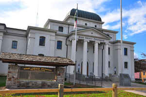
Avery County is a county located in the state of North Carolina. Based on the 2010 census, the population was 17,797. The county seat is Newland. The county seat was initially established in Elk Park when the county was first formed, but was moved to Newland upon completion of the courthouse in 1912. Founded in 1911, it is the youngest of North Carolina's 100 counties.
Etymology - Origin of Avery County Name
It was named in honor of Colonel Waightstill Avery, a soldier of the Revolution and Attorney General of North Carolina.
Demographics:
County QuickFacts: CensusBureau Quick Facts
Avery County History
Avery County was formed in 1911 from Mitchell, Watauga, and Caldwell. It was named in honor of Colonel Waightstill Avery, a soldier of the Revolution and Attorney General of North Carolina. It is in the northwestern section of the State and is bounded by the state of Tennessee and the counties of Watauga, Caldwell, Burke, McDowell and Mitchell. The present land area is 247.00 square miles and the 2000 population was 17,167. Commissioners were named in the act establishing the county who were to select two or more sites for the county seat after which the county would vote on the sites. Newland is the county seat.
Geography: Land and Water
As reported by the Census Bureau, the county has a total area of 247 square miles (640 km2), of which 247 square miles (640 km2) is land
and 0.1 square miles (0.26 km2) (0.06%) is water.
Avery County is extremely rural and mountainous with all of the county's terrain located within the Appalachian Mountains range. The highest
point in the county is Grassy Ridge Bald, which rises to 6,165 feet (1,879 m) above sea level. Most of Grandfather Mountain (whose highest
point is Calloway Peak 5,946 feet (1,812 m) shared with Watauga and Caldwell counties) is within Avery county. At an elevation of 5,526 feet
(1,678 m) above sea level, Beech Mountain (also shared with Watauga county) is the highest incorporated community east of the Mississippi
River. At an elevation of 3,606 feet (1,099 m) Newland is the highest county seat in the Eastern USA.
Neighboring Counties
Bordering counties are as follows:
- Johnson County, Tennessee - north
- Carter County, Tennessee - west
- Caldwell County - east
- Burke County - southeast
- McDowell County -south
- Mitchell County - southwest
- Watauga County- northeast
Education
Avery County Schools has eight schools housed on seven campuses, ranging from pre-kindergarten to twelfth grade: five elementary schools, two middle schools and a central high school.
Charter schools
Two authorized charter schools operate in Avery County:
- Crossnore Academy, formerly an orphanage in the Town of Crossnore
- Grandfather Academy, formerly Grandfather Home Orphanage in Banner Elk
Colleges and universities
- Lees-McRae College (LMC), located in Banner Elk, is a private, four-year liberal arts college that is Presbyterian Church affiliated.
- Mayland Community College (MCC), located straddling along the county line of both Avery and Mitchell Counties, is a public community college, which offers associate's degrees and a university-parallel college transfer program towards a bachelor's degree.


Click Image to Enlarge
