


Click Image to Enlarge
North Carolina Counties
North Carolina is divided into one hundred counties. The establishment of North Carolina counties stretches over 240 years, beginning in 1668 with the creation of Albemarle County and ending with the 1911 creation of Avery and Hoke counties. Five counties have been divided or abolished altogether, the last being Dobbs County in 1791.Brunswick County, North Carolina
Brunswick County Education, Geography, and History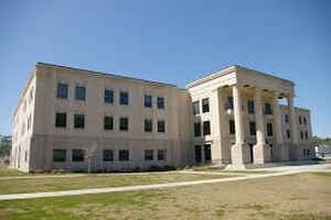
Brunswick County is a county in the state of North Carolina. Based on the 2010 census, the population was 107,431. Its county seat is
Bolivia.
Brunswick County is included in the Myrtle Beach-Conway-North Myrtle Beach, SC-NC Metropolitan Statistical Area. It was formerly part of the
Wilmington, NC Metropolitan Statistical Area. Wilmington area leaders disputed the change, but unsuccessfully.
Etymology - Origin of Brunswick County Name
t was named in honor of the town of Brunswick, which was named for King George I, Duke of Brunswick and Lunenberg.
Demographics:
County QuickFacts: CensusBureau Quick Facts
Brunswick County History
Brunswick was formed in 1764 from New Hanover and Bladen. It was named in honor of the town of Brunswick, which was named for King George I, Duke of Brunswick and Lunenberg. It is in the southeastern section of the State and is bounded by the Atlantic Ocean, the Cape Fear River, the state of South Carolina, and Columbus, Pender and New Hanover counties. The present land area is 854.79 square miles and the population in 2000 was 73,141. Brunswick, established in 1745, was made a borough town in 1754, and when Brunswick County was established in 1764 it was made the county seat. In 1779 the county seat was authorized to be moved to the plantation of John Bell near Lockwood's Folly Bridge. In 1784 Walkersburg, named in honor of John Walker on whose land it was situated, was established. Provisions were made in the act for a courthouse and other public buildings to be established there. It was located near Deep Water Point. This act specified that the courts were to be held at the most convenient place until the courthouse was completed. It is doubtful that the act was put into effect because in 1808 an act was passed authorizing the removal of the courthouse from Lockwood's Folly to Smithville. Court was held at the courthouse from 1805-1858. The record does not indicate where the courthouse was. This town, established in 1792, was named in honor of Benjamin Smith, Governor of North Carolina, 1810-1811. In 1879 an effort to move the courthouse failed. In 1887 Smithville was changed to Southport. Southport served as the county seat until 1977 when the county seat was moved to Bolivia, following a referendum on the question.
Geography: Land and Water
As reported by the Census Bureau, the county has a total area of 1,050 square miles (2,700 km2), of which 547 square miles (1,420 km2)
is land and 203 square miles (530 km2) (19%) is water. It is the fourth-largest county in North Carolina by total area. The Brunswick River
and the Cape Fear River provide access to the Atlantic Ocean.
The Brunswick Nuclear Generating Station is to the north of Southport.
Neighboring Counties
Bordering counties are as follows:
- Pender County - northeast
- New Hanover County - east
- Horry County, South Carolina - southwest
- Columbus County - northwest
Education


Click Image to Enlarge
