


Click Image to Enlarge
North Carolina Counties
North Carolina is divided into one hundred counties. The establishment of North Carolina counties stretches over 240 years, beginning in 1668 with the creation of Albemarle County and ending with the 1911 creation of Avery and Hoke counties. Five counties have been divided or abolished altogether, the last being Dobbs County in 1791.Currituck County, North Carolina
Currituck County Education, Geography, and History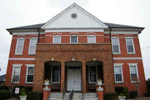
Currituck County is the northeastern-most county in the state of North Carolina. Based on the 2010 census, the population was 23,547. Its
county seat is Currituck. The county was formed in 1668 as a precinct of Albemarle County and later gained county status in 1739. The name is
"traditionally said to be an Indian word for wild geese; Coratank."
It is in the northeastern section of the state and is bounded by the Atlantic Ocean, Currituck Sound, Camden County, Dare County and the state
of Virginia. Currituck Court House, mentioned as early as 1755, was the name of the county seat. Today the words "Court House" have been
dropped and only Currituck is used as the town name.
Currituck County is included in the Virginia Beach-Norfolk-Newport News, VA-NC Metropolitan Area.
Etymology - Origin of Currituck County Name
It is "traditionally said to be an Indian word for wild geese; Coratank."
Demographics:
County QuickFacts: CensusBureau Quick Facts
Currituck County History
Currituck was formed as early as 1668 as a precinct of Albemarle County. It is "traditionally said to be an Indian word for wild geese; Coratank." It is in the northeastern section of the State and is bounded by the Atlantic Ocean, Albemarle Sound, Camden County, and the state of Virginia. The present land area is 261.70 square miles and the 2000 population was 18,190. Currituck Court House, mentioned as early as 1755, was the name of the county seat. Today the words "Court House" have been dropped and only Currituck is used.
Geography: Land and Water
As reported by the Census Bureau, the county has a total area of 527 square miles (1,360 km2), of which 262 square miles (680 km2) is
land and 265 square miles (690 km2) (50%) is water.
Currituck County includes the northern communities of North Carolina's Outer Banks, separated from mainland Currituck County by the Currituck
Sound.
Neighboring Counties
Bordering counties are as follows:
- Chesapeake, Virginia (north)
- Virginia Beach, Virginia (north)
- Dare County (southeast)
- Camden County (west)
Education
Currituck County Schools are governed by a five-member, elected Board of Education.


Click Image to Enlarge
