


Click Image to Enlarge
North Carolina Counties
North Carolina is divided into one hundred counties. The establishment of North Carolina counties stretches over 240 years, beginning in 1668 with the creation of Albemarle County and ending with the 1911 creation of Avery and Hoke counties. Five counties have been divided or abolished altogether, the last being Dobbs County in 1791.Davie County, North Carolina
Davie County Education, Geography, and History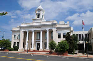
Davie County is a county located in the state of North Carolina. Based on the 2010 census, the population was 41,240. Its county seat is
Mocksville.
Davie County is included in the Winston-Salem, NC Metropolitan Statistical Area, which is also included in the Greensboro-Winston-Salem-High
Point, NC Combined Statistical Area.
Etymology - Origin of Davie County Name
t was named in honor of William Richardson Davie, a distinguished Revolutionary soldier, a member of the Federal Convention of 1787, Governor of North Carolina, special envoy extraordinary and minister plenipotentiary to France, and one of the founders of the University of North Carolina.
Demographics:
County QuickFacts: CensusBureau Quick Facts
Davie County History
Davie was formed in 1836 from Rowan. It was named in honor of William Richardson Davie, a distinguished Revolutionary soldier, a member of the Federal Convention of 1787, Governor of North Carolina, special envoy extraordinary and minister plenipotentiary to France, and one of the founders of the University of North Carolina. It is in the central section of the State and is bounded by Davidson, Rowan, Iredell, Yadkin, and Forsyth counties. The present land area is 265.18 square miles and the population in 2000 was 34,835. In 1837 the court was ordered to be held at Mocksville. Mocksville, incorporated in 1839, is the county seat.
Geography: Land and Water
As reported by the Census Bureau, the county has a total area of 267 square miles (690 km2), of which 264 square miles (680 km2) is land and 3.0 square miles (7.8 km2) (1.1%) is water.
Neighboring Counties
Bordering counties are as follows:
- Yadkin County - north
- Forsyth County - northeast
- Davidson County - southeast
- Rowan County - south
- Iredell County - west
Education


Click Image to Enlarge
