


Click Image to Enlarge
North Carolina Counties
North Carolina is divided into one hundred counties. The establishment of North Carolina counties stretches over 240 years, beginning in 1668 with the creation of Albemarle County and ending with the 1911 creation of Avery and Hoke counties. Five counties have been divided or abolished altogether, the last being Dobbs County in 1791.Forsyth County, North Carolina
Forsyth County Education, Geography, and History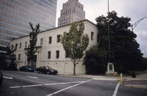
Forsyth County is a county located in the state of North Carolina. Based on the 2010 census, the population was 350,670, making it the
fourth-most populous county in North Carolina. Its county seat is Winston-Salem.
Forsyth County is included in the Winston-Salem, NC Metropolitan Statistical Area, which is also included in the Greensboro-Winston-Salem-High
Point, NC Combined Statistical Area.
Etymology - Origin of Forsyth County Name
It was named in honor of Colonel Benjamin Forsyth, a native of Stokes County who fell on the northern frontier in the second war with England.
Demographics:
County QuickFacts: CensusBureau Quick Facts
Forsyth County History
Forsyth was formed in 1849 from Stokes. It was named in honor of Colonel Benjamin Forsyth, a native of Stokes County who fell on the northern frontier in the second war with England. It is in the central section of the State and is bounded by Guilford, Davidson, Davie, Yadkin, and Stokes counties. The present land area is 409.60 square miles and the 2000 population was 306,067. The act establishing the county ordered the first court to be held at the town hall of Salem, at which time the justices were to select a place for future courts until a courthouse could be erected. Commissioners were named to select a place for the public buildings, acquire the land, and lay out a town. In 1851 an act was passed naming the county seat Winston. In 1879 an act was passed authorizing that Winston and Salem be combined, provided the people voted for the same. In 1913 Winston and Salem were incorporated as one town and Winston-Salem became the county seat.
Geography: Land and Water
As reported by the Census Bureau, the county has a total area of 413 square miles (1,070 km2), of which 408 square miles (1,060 km2) is land and 4.5 square miles (12 km2) (1.1%) is water.
Neighboring Counties
Bordering counties are as follows:
- Stokes County - north
- Rockingham County - northeast
- Guilford County - east
- Davidson County - south
- Davie County - southwest
- Yadkin County - west
- Surry County - northwest
Education


Click Image to Enlarge
