


Click Image to Enlarge
North Carolina Counties
North Carolina is divided into one hundred counties. The establishment of North Carolina counties stretches over 240 years, beginning in 1668 with the creation of Albemarle County and ending with the 1911 creation of Avery and Hoke counties. Five counties have been divided or abolished altogether, the last being Dobbs County in 1791.Gates County, North Carolina
Gates County Education, Geography, and History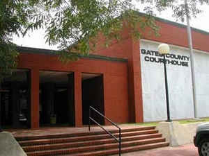
Gates County is a small, rural county located in the state of North Carolina. Based on the 2010 census, the population was 12,197. Its
county seat is Gatesville.
Gates County is included in the Virginia Beach-Norfolk-Newport News, VA-NC Metropolitan Statistical Area. It is part of the Albemarle Sound
area of the Inner Banks.
Etymology - Origin of Gates County Name
It was named in honor of General Horatio Gates, who commanded American Army at the Battle of Saratoga.
Demographics:
County QuickFacts: CensusBureau Quick Facts
Gates County History
Gates was formed in 1779 from Chowan, Hertford, and Perquimans counties. It was named in honor of General Horatio Gates, who commanded American Army at the Battle of Saratoga. It is in the northeastern section of the State and is bounded by Camden, Pasquotank, Perquimans, Chowan and Hertford counties, and the state of Virginia. The present land area is 340.61 square miles and the population in 2000 was 10,516. The act establishing the county provided that commissioners be appointed to select a site centrally located for the erection of a courthouse, etc., and to have the building erected. In 1781, an act was passed to levy an additional tax for the completion of the public buildings. The Legislature of 1830-31 passed an act which said that the place now known as Gates Court House, in the county of Gates, shall in the future be known and described by the name of Gatesville. Gatesville is the county seat.
Geography: Land and Water
As reported by the Census Bureau, the county has a total area of 346 square miles (900 km2), of which 340 square miles (880 km2) is land
and 5.2 square miles (13 km2) (1.5%) is water.
The counties of Gates, Perquimans, Camden and Currituck contain sixty percent of the Great Dismal swamp. In 1973, Union Camp donated the land
which it owned in the swamp to the Nature Conservancy. The Conservancy next donated the land to the Department of The Interior, and the Great
Dismal Swamp National Wildlife Refuge was created. The refuge consists of 107,000 acres (430 km2) of swamp and wetlands' surrounding Lake
Drummond.
Neighboring Counties
Bordering counties are as follows:
- Suffolk, Virginia - north
- Camden County - northeast
- Pasquotank County - east
- Perquimans County - southeast
- Chowan County - south
- Hertford County - west
- Southampton County, Virginia - northwest
Education
Gates County Schools has five schools ranging from pre-kindergarten to twelfth grade. Those five schools are separated into one high school (Gates County Senior High School), one middle school, and three elementary schools.


Click Image to Enlarge
