


Click Image to Enlarge
North Carolina Counties
North Carolina is divided into one hundred counties. The establishment of North Carolina counties stretches over 240 years, beginning in 1668 with the creation of Albemarle County and ending with the 1911 creation of Avery and Hoke counties. Five counties have been divided or abolished altogether, the last being Dobbs County in 1791.Iredell County, North Carolina
Iredell County Education, Geography, and History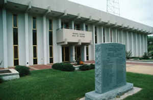
Iredell County is a county located in the state of North Carolina. Based on the 2010 census, the population was 159,437. Its county seat
is Statesville, and its largest town is Mooresville. The county was formed in 1788, annexed from Rowan County. It is named for James Iredell,
a justice of the Supreme Court of the United States.
Iredell County is included in the Charlotte-Concord-Gastonia, NC-SC Metropolitan Statistical Area.
Etymology - Origin of Iredell County Name
It was named in honor of James Iredell of Edenton. He was one of the leaders of the State advocating the adoption of the Federal Constitution.
Demographics:
County QuickFacts: CensusBureau Quick Facts
Iredell County History
Iredell was formed in 1788 from Rowan. It was named in honor of James Iredell of Edenton. He was one of the leaders of the State advocating the adoption of the Federal Constitution. Washington appointed him a judge of the Supreme Court of the United States in 1790. It is in the central section of the State and is bounded by Rowan, Cabarrus, Mecklenburg, Lincoln, Catawba, Alexander, Wilkes, Yadkin and Davie counties. The present land area is 575.57 square miles and the 2000 population was 122,660. Statesville, established in 1789, is the county seat.
Geography: Land and Water
As reported by the Census Bureau, the county has a total area of 597 square miles (1,550 km2), of which 574 square miles (1,490 km2) is
land and 23 square miles (60 km2) (3.9%) is water.
Iredell County is located within the Piedmont Region of central North Carolina. The northwestern section of the county contains the Brushy
Mountains, a deeply eroded spur of the Blue Ridge Mountains far to the west. The highest point in Iredell County, Fox Mountain, is in the
Brushies; it rises to 1,760 feet. Although the "Brushies", as they are often called locally, are not high in the normal sense, they do rise
prominently above the surrounding countryside. The remainder of Iredell County consists of gently rolling countryside occasionally broken by
low hills and small river valleys. The county's largest river, the Catawba, forms much of its western border. Lake Norman, North Carolina's
largest manmade lake, is the most prominent geographic feature of southern Iredell County; it is often called North Carolina's "inland sea".
The northern third of Iredell county is highly rural and contains no large towns. Iredell County is one of the longest counties in the state
and stretches for nearly fifty miles north to south from Yadkin County in the north to Mecklenburg in the south. The county is divided into
seventeen townships.
Neighboring Counties
Bordering counties are as follows:
- Yadkin County - north
- Davie County - east
- Rowan County - east
- Cabarrus County - southeast
- Mecklenburg County - south
- Lincoln County - southwest
- Catawba County - southwest
- Alexander County - west
- Wilkes County - north
Education
The county is served by the Iredell-Statesville Schools school district.


Click Image to Enlarge
