


Click Image to Enlarge
North Carolina Counties
North Carolina is divided into one hundred counties. The establishment of North Carolina counties stretches over 240 years, beginning in 1668 with the creation of Albemarle County and ending with the 1911 creation of Avery and Hoke counties. Five counties have been divided or abolished altogether, the last being Dobbs County in 1791.Moore County, North Carolina
Moore County Education, Geography, and History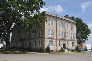
Moore County is a county located in the state of North Carolina. Based on the 2010 census, the population was 88,247.Its county seat is
Carthage and its largest town is Pinehurst.
Moore County comprises the Aberdeen- Pinehurst-Southern Pines, North Carolina Micropolitan Statistical Area and is sometimes included in the
Research Triangle and Greater Raleigh-Durham CSA. It lies at the northern edge of the area known as the Sandhills region.
Etymology - Origin of Moore County Name
It was named in honor of Captain Alfred Moore of Brunswick. a soldier of the Revolution and afterwards a Justice of the Supreme Court of the United States.
Demographics:
County QuickFacts: CensusBureau Quick Facts
Moore County History
Moore was formed in 1784 from Cumberland. It was named in honor of Captain Alfred Moore of Brunswick. a soldier of the Revolution and afterwards a Justice of the Supreme Court of the United States. It is in the south central section of the State and is bounded by Cumberland, Harnett, Hoke, Scotland, Richmond, Montgomery, Randolph, Chatham and Lee counties. The present land area is 697.74 square miles and the 2000 population was 74,762. The act establishing the county provided for the erection of the public buildings. In 1795 an act was passed which stated that the location of the courthouse was inconvenient; it named commissioners to purchase land near the center of the county and erect a new courthouse. In 1796 an act was passed establishing Carthage on land where the courthouse was to stand. In 1803 an act was passed naming commissioners to lay out a town and build a courthouse as directed in the 1796 act. In 1806 Carthage was changed to Fagansville. In 1818, Fagansville was changed back to Carthage. Carthage is the county seat.
Geography: Land and Water
As reported by the Census Bureau, the county has a total area of 706 square miles (1,830 km2), of which 698 square miles (1,810 km2) is land and 8.0 square miles (21 km2) (1.1%) is water.
Neighboring Counties
Bordering counties are as follows:
- Chatham County - north
- Lee County - northeast
- Harnett County - east
- Cumberland County - southeast
- Hoke County - southeast
- Scotland County - south
- Richmond County - southwest
- Montgomery County - west
- Randolph County - north
Education


Click Image to Enlarge
