


Click Image to Enlarge
North Carolina Counties
North Carolina is divided into one hundred counties. The establishment of North Carolina counties stretches over 240 years, beginning in 1668 with the creation of Albemarle County and ending with the 1911 creation of Avery and Hoke counties. Five counties have been divided or abolished altogether, the last being Dobbs County in 1791.Rutherford County, North Carolina
Rutherford County Education, Geography, and History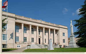
Rutherford County is a county located in the state of North Carolina. Based on the 2010 census, the population was 67,810. Its county
seat is Rutherfordton.
Rutherford County comprises the Forest City, NC Micropolitan Statistical Area.
Etymology - Origin of Rutherford County Name
t was named in honor of Griffith Rutherford, one of the most prominent of the Revolutionary patriots. He led the expedition that crushed the Cherokees in 1776, and rendered important services both in the Legislature and on the battlefield.
Demographics:
County QuickFacts: CensusBureau Quick Facts
Rutherford County History
Rutherford was formed in 1779 from Tryon. It was named in honor of Griffith Rutherford, one of the most prominent of the Revolutionary patriots. He led the expedition that crushed the Cherokees in 1776, and rendered important services both in the Legislature and on the battlefield. It is in the southwestern section of the State and is bounded by the state of South Carolina and Polk, Henderson, McDowell, Burke and Cleveland counties. Its present land area is 564.12 square miles and the 2000 population was 62,901. The act establishing the county provided that the first court be held at the home of Joseph Walker and the justices were to decide on the most convenient place to hold succeeding courts until a courthouse could be erected. Commissioners were named to select a place for the county seat. In 1781 an act was passed stating that the original act had not been fully carried out and that the previous commissioners had failed to erect a courthouse even though they had selected the land of James Holland in the fork of Shepard's Creek. The act authorized the commissioners to purchase fifty acres of land from James Holland and erect the buildings. In 1784 an act was passed which stated that the place selected by the commissioners was not convenient; therefore, new commissioners were named to survey the county, locate the center, purchase land and erect the public buildings. In 1787 Rutherford was established on the land purchased for the county seat. Two acres were reserved for the public buildings. Rutherfordton was incorporated in 1793 and is the county seat.
Geography: Land and Water
As reported by the Census Bureau, the county has a total area of 566 square miles (1,470 km2), of which 564 square miles (1,460 km2) is land and 1.7 square miles (4.4 km2) (0.3%) is water.
Neighboring Counties
Bordering counties are as follows:
- McDowell County - north
- Burke County - northeast
- Cleveland County - east
- Cherokee County, South Carolina - south
- Spartanburg County, South Carolina - south
- Polk County - southwest
- Henderson County - west
- Buncombe County - northwest
Education


Click Image to Enlarge
