


Click Image to Enlarge
North Carolina Counties
North Carolina is divided into one hundred counties. The establishment of North Carolina counties stretches over 240 years, beginning in 1668 with the creation of Albemarle County and ending with the 1911 creation of Avery and Hoke counties. Five counties have been divided or abolished altogether, the last being Dobbs County in 1791.Swain County, North Carolina
Swain County Education, Geography, and History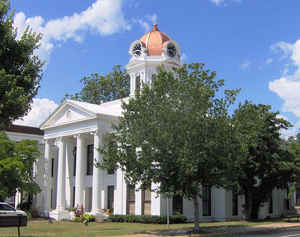
Swain County is a county located in the western portion of the state of North Carolina. Based on the 2010 census, the population was
13,981. Its county seat is Bryson City.
Swain County is home of the Nantahala River (along with Macon County, North Carolina). The Nantahala is one of the most popular whitewater
rafting rivers in the nation. In 2010, it was announced that the Nantahala River would host the 2013 World Freestyle Kayaking Championships.
The Oconaluftee River also flows through Swain County in the town of Cherokee.
Etymology - Origin of Swain County Name
It was named in honor of David L. Swain, Governor of North Carolina and president of the University of North Carolina.
Demographics:
County QuickFacts: CensusBureau Quick Facts
Swain County History
Swain was formed in 1871 from Jackson and Macon. It was named in honor of David L. Swain, Governor of North Carolina and president of the University of North Carolina. It in the western section of the State and is bounded by the state of Tennessee and Haywood, Jackson, Macon, Cherokee, and Graham counties. The present land area is 528.10 square miles and the 2000 population was 12,968. The first court was ordered to be held at Cold Spring Meeting House. Special commissioners were named to select a site for the courthouse, provided all the commissioners could agree on a certain place. If they could not agree, the county commissioners were to submit the question of selecting a place to the voters. The county commissioners were to lay out a town by the name of Charleston which was to be the county seat. In 1889 Charleston was changed to Bryson City in honor of Colonel Thad Dillard Bryson. Bryson City is the county seat.
Geography: Land and Water
As reported by the Census Bureau, the county has a total area of 541 square miles (1,400 km2), of which 528 square miles (1,370 km2) is
land and 13 square miles (34 km2) (2.3%) is water.
The county is located in the western part of North Carolina in the Great Smoky Mountains and has a larger proportion of the Great Smoky
Mountains National Park than any other county in North Carolina or Tennessee.
The highest point in the county is Clingmans Dome, elevation 6,643 feet, located on the NC/TN border. This mountain is the third highest peak
in North Carolina, and an observation tower is located on its summit.
Neighboring Counties
Bordering counties are as follows:
- Sevier County, Tennessee - north
- Haywood County - east
- Jackson County - southeast
- Macon County - south
- Graham County - southwest
- Blount County, Tennessee - northwest
Education


Click Image to Enlarge
