


Click Image to Enlarge
North Carolina Counties
North Carolina is divided into one hundred counties. The establishment of North Carolina counties stretches over 240 years, beginning in 1668 with the creation of Albemarle County and ending with the 1911 creation of Avery and Hoke counties. Five counties have been divided or abolished altogether, the last being Dobbs County in 1791.Transylvania County, North Carolina
Transylvania County Education, Geography, and History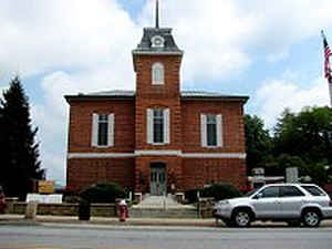
Transylvania County is a county located in the state of North Carolina. Based on the 2010 census, the population was 33,090. Its county seat
is Brevard.
Transylvania County comprises the Brevard, NC Micropolitan Statistical Area, which is also included in the Asheville-Brevard, NC Combined
Statistical Area.
Etymology - Origin of Transylvania County Name
It's name is derived from the Latin words, trans meaning "across" and sylva meaning "woods."
Demographics:
County QuickFacts: CensusBureau Quick Facts
Transylvania County History
Transylvania was formed in 1861 from Henderson and Jackson. It's name is derived from the Latin words, trans meaning "across" and sylva meaning "woods." It is in the western section of the State and is bounded by the State of South Carolina and Jackson, Haywood and Henderson counties. The present land area is 378.39 square miles and the population in 2000 was 29,334. The first court was to be held at the home of B. C. Langford. Commissioners were named to select a site for the public buildings within five miles of W. P. Poor's store and to acquire land and lay out Brevard. Brevard is the county seat.
Geography: Land and Water
As reported by the Census Bureau, the county has a total area of 381 square miles (990 km2), of which 379 square miles (980 km2) is land
and 2.0 square miles (5.2 km2) (0.5%) is water.
There are over 250 waterfalls in the county. Receiving over 90 inches of rain annually, Transylvania County is the wettest county in the
state. This is contrasted with Buncombe County, which is thirty miles northeast of Transylvania County receiving the lowest precipitation. The
Blue Ridge Parkway traverses through parts of the county, affording spectacular views of the Appalachian Mountains, which reach over 6,000
feet (1,800 m) elevation in the county. The highest point, Chestnut Knob, 6,025 feet (1,836 m), lies northwest of the county seat Brevard.
Neighboring Counties
Bordering counties are as follows:
- Henderson County - east
- Greenville County, South Carolina - southeast
- Pickens County, South Carolina - south
- Oconee County, South Carolina - southwest
- Jackson County - west
- Haywood County - northwest
- Buncombe County - northeast
Education


Click Image to Enlarge
