


Click Image to Enlarge
North Carolina Counties
North Carolina is divided into one hundred counties. The establishment of North Carolina counties stretches over 240 years, beginning in 1668 with the creation of Albemarle County and ending with the 1911 creation of Avery and Hoke counties. Five counties have been divided or abolished altogether, the last being Dobbs County in 1791.Union County, North Carolina
Union County Education, Geography, and History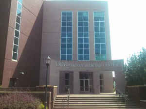
Union County is a county located in the state of North Carolina. Based on the 2010 census, the population was 201,292. Its county seat is
Monroe.
Union County is included in the Charlotte-Concord-Gastonia, NC-SC Metropolitan Statistical Area.
Etymology - Origin of Union County Name
At the time the county was formed there was a dispute between local Whigs and Democrats as to whether it should be named Clay or Jackson. The name Union was suggested and adopted as a compromise because the new county was created from parts of two others.
Demographics:
County QuickFacts: CensusBureau Quick Facts
Union County History
Union was formed in 1842 from Anson and Mecklenburg. At the time the county was formed there was a dispute between local Whigs and Democrats as to whether it should be named Clay or Jackson. The name Union was suggested and adopted as a compromise because the new county was created from parts of two others. It is in the south central section of the State and is bounded by the state of South Carolina and Mecklenburg, Cabarrus, Stanly and Anson counties. The present land area is 637.37 square miles and the 2000 population was 123,772. Commissioners were named in the act to select a site, lay out a town by the name of Monroe, and erect a courthouse. Monroe is the county seat.
Geography: Land and Water
As reported by the Census Bureau, the county has a total area of 640 square miles (1,700 km2), of which 632 square miles (1,640 km2) is land and 8.0 square miles (21 km2) (1.3%) is water.
Neighboring Counties
Bordering counties are as follows:
- Cabarrus County - north
- Stanly County - northeast
- Anson County - east
- Chesterfield County, South Carolina - southeast
- Lancaster County, South Carolina - southwest
- Mecklenburg County - northwest
Education
South Piedmont Community College


Click Image to Enlarge
