


Click Image to Enlarge
North Carolina Counties
North Carolina is divided into one hundred counties. The establishment of North Carolina counties stretches over 240 years, beginning in 1668 with the creation of Albemarle County and ending with the 1911 creation of Avery and Hoke counties. Five counties have been divided or abolished altogether, the last being Dobbs County in 1791.Yadkin County, North Carolina
Yadkin County Education, Geography, and History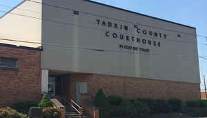
Yadkin County is a county located in the state of North Carolina. Based on the 2010 census, the population was 38,406. Its county seat is
Yadkinville.
Yadkin County is included in the Winston-Salem, NC Metropolitan Statistical Area, which is also included in the Greensboro-Winston-Salem-High
Point, NC Combined Statistical Area.
Etymology - Origin of Yadkin County Name
Its name is derived from the Yadkin River which runs through it.
Demographics:
County QuickFacts: CensusBureau Quick Facts
Yadkin County History
Yadkin was formed in 1850 from Surry. Its name is derived from the Yadkin River which runs through it. It is in the north central section of the State and is bounded by Forsyth, Davie, Iredell, Wilkes and Surry counties. The present land area is 335.55 square miles and the 2000 population was 36,348. The first court was ordered to be held at Dowellton, at which time the justices were to adjourn to any place they wished until a courthouse could be erected. Commissioners were named to select a site for the courthouse as near of the center of the county as possible. Also, they were to acquire land and lay off a town by the name of Wilson. In 1852 an act was passed changing Wilson to Yadkinville. Yadkinville is the county seat.
Geography: Land and Water
As reported by the Census Bureau, the county has a total area of 338 square miles (880 km2), of which 335 square miles (870 km2) is land
and 2.7 square miles (7.0 km2) (0.8%) is water.
Yadkin County is located in the Piedmont region of central North Carolina. The Piedmont consists of rolling farmlands frequently broken by
hills or valleys formed by streams. The extreme western section of the county contains the Brushy Mountains, a deeply eroded spur of the much
higher Blue Ridge Mountains to the west. Yadkin County marks the eastern end of the Brushy Mountains range; none of the peaks rise more than
400 - 500 feet above the surrounding countryside. The highest point in the county is Star Peak near Jonesville, at 1,590 feet above sea level.
The Yadkin River forms the county's northern and eastern borders. The county takes its name from the river.
Neighboring Counties
Bordering counties are as follows:
- Surry County - north
- Forsyth County - east
- Davie County - south-southeast
- Iredell County - south-southwest
- Wilkes County - west
Education
Yadkin County has three high schools, Forbush, Starmount, and the Yadkin Early College.


Click Image to Enlarge
