


Click Image to Enlarge
Utah Counties
There are twenty-nine counties in the State of Utah. There were originally seven counties established under the provisional State of Deseret in 1849: Davis, Iron, Sanpete, Salt Lake, Tooele, Utah, and Weber. The Territory of Utah was created in 1851 with the first territorial legislature meeting from 1851-1852. The first legislature re-created the original counties from the State of Deseret under territorial law as well as establishing three additional counties: Juab, Millard, and Washington. All other counties were established between 1854 and 1894 by the Utah Territorial Legislature under territorial law except for the last two counties formed, Daggett and Duchesne.Garfield County, Utah
Garfield County Education, Geography, and History
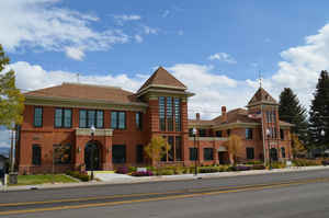
Garfield County is a county located in the state of Utah. Based on the 2010 census, the population was 5,172, making it the fifth-least populous county in Utah. Its county seat and largest city is Panguitch
Etymology - Origin of Garfield County Name
Garfield County was named for James A. Garfield, late President of the United States, who had been assassinated in 1881.
Demographics:
County QuickFacts: CensusBureau Quick Facts
Garfield County History
The Colorado River and Lake Powell mark the eastern border of remote, sparsely populated Garfield County. Other geographical features include the Henry Mountains in the northeast and the forested, high plateaus in the western half of the county. The two areas have 11 peaks over 10,000 feet. The Sevier River system runs north through western Garfield, and the Escalante River empties into the Colorado.Traces of the two major prehistoric formative Indian cultures -the Fremont and Anasazi-- have been found in the county. In historic times Southern Paiutes and Utes used the land.
The first white settlers made the difficult trip from Beaver and Parowan through the mountains to the Panguitch area in March 1864. The village, abandoned during the Black Hawk War (1865-68), was not resettled until 1871. The territorial legislature created the county in 1882 and, at the suggestion of Gov. Eli H. Murray, named it after assassinated President James A. Garfield. Boulder, settled in 1889, was the most isolated town in Utah until the mid-1930s when Civilian Conservation Corps (CCC) workers constructed a road from Boulder to Escalante. The CCC also reseeded ranges and built telephone lines, ranger stations, and trails.
Vast rangelands and some of the state's largest forest reserves have made cattle ranching and lumber Garfield County's most important industries since pioneer times. The forests also provide many recreational sites, and Panguitch Lake is one of the state's prime fishing waters. The creation of Bryce Canyon National Park in 1928 increased the importance of tourism to the local economy. The large sections of Capitol Reef National Park and the Glen Canyon National Recreation Area that lie within the county remained largely inaccessible in the late 1980s. The proposed, controversial paving of the Burr Trail through the Waterpocket Fold area of Capitol Reef would, however, expand travel in eastern Garfield. The seasonal nature of lumbering and tourism often gives the county higher than average unemployment.
The Upper Valley oil field in central Garfield is a sizeable oil producing area. The county also has large coal fields as well as tar sands and uranium, but these energy-related resources have not been developed. Mining for other minerals has been very limited.
*Sources: Beehive History 14: Utah Counties. 1988. Utah State Historical Society, 300 Rio Grande, Salt Lake City, UT 84101-1182
Geography: Land and Water
As reported by the Census Bureau, the county has a total area of 5,208 square miles (13,489 km2), of which, 5,174 square miles (13,401 km2) of it is land and 34 square miles (88 km2) of it (0.65%) is water.
The
Colorado River, passing through a deep gorge, forms the eastern boundary. Westward, the cliffs of tributary
canyons give way to the barren stretches of the San Rafael Desert, beyond which a variety of mountains, plateaus
and canyons make up the terrain. Most of Bryce Canyon National Park lies in the southwestern part of the county.
A large portion of Capitol Reef National Park lies in the east-central part of the county. A very small part of Canyonlands National Park lies in the northeast corner of the county.
Neighboring Counties
Bordering counties are as follows:
- Wayne County, Utah - (north)
- San Juan County, Utah - (east)
- Kane County, Utah - (south)
- Iron County, Utah - (west)
- Beaver County, Utah - (northwest)
- Piute County, Utah - (northwest)
Education


Click Image to Enlarge
