


Click Image to Enlarge
Utah Counties
There are twenty-nine counties in the State of Utah. There were originally seven counties established under the provisional State of Deseret in 1849: Davis, Iron, Sanpete, Salt Lake, Tooele, Utah, and Weber. The Territory of Utah was created in 1851 with the first territorial legislature meeting from 1851-1852. The first legislature re-created the original counties from the State of Deseret under territorial law as well as establishing three additional counties: Juab, Millard, and Washington. All other counties were established between 1854 and 1894 by the Utah Territorial Legislature under territorial law except for the last two counties formed, Daggett and Duchesne.Millard County, Utah
Millard County Education, Geography, and History
Millard County is a county located in the state of Utah. Based on the 2010 census, the population was 12,503. Its county seat is Fillmore, and the largest city is Delta. The county was created in 1851.
Etymology - Origin of Millard County Name
The county and its seat were named for Millard Fillmore, thirteenth President of the United States
Demographics:
County QuickFacts: CensusBureau Quick Facts
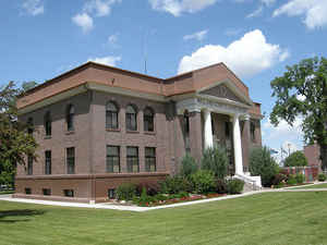
Millard County History
Millard County is bordered on the
east by the Pahvant Range. West to the Nevada border lie the broad valleys and
desert mountain ranges typical of the Great Basin. The Sevier River, which
begins in mountains east of Cedar City, drains into the sometimes dry Sevier
Lake in central Millard. A huge granitic upthrust in the House Range, volcanic
cones, and numerous fossil beds provide clues to past geologic activity and
prehistoric animal and plant life.
The county is known for a Folsom Early Man site in the Sevier Desert occupied
7,000 or 8,000 years ago. In addition, the Fremont Culture which disappeared ca.
A.D. 1300 lived in small villages with semi-subterranean dwellings. Historic
Indian groups include Southern Paiutes, Pahvant Utes, and Goshutes. A small
Indian reservation is located at Kanosh.
In October 1851 two groups left Salt Lake City for east Millard County. Some 30
families led by Anson Call made the first permanent white settlement, while
territorial officials, including Gov. Brigham Young and surveyor Jesse W. Fox,
selected a site for the capital, Fillmore being near the geographical center of
Utah Territory. The legislature met in Fillmore a few times, but in December
1856 it voted to move the capital to Salt Lake City because Fillmore was too far
from major cities.
On October 26, 1853, seven members of a transcontinental railroad survey team
led by Lt. John W. Gunnison of the Topographical Engineers were killed southwest
of Delta by Indians, a tragic incident in the Walker War (1853-54) that was
apparently triggered by the hostile actions of a group of emigrants against the
Indians.
Ranching and farming developed slowly. In the early 20th century Millard was
second to Tooele in the number of sheep on its ranges, but later cattle became
the major livestock interest. The establishment of the Union Pacific line
through west Millard County and the founding of Delta in 1907 led to the most
important agricultural development - large-scale alfalfa seed production
amounting eventually to three-fourths of the state's crop. The Yuba Dam and
other water projects made this venture possible.
During World War II the federal government forcibly relocated 110,000
Japanese-Americans from their West Coast homes to special camps. Topaz, a
relocation center near Delta, housed some 8,700 internees, making it the largest
"city" in Millard for a few years.
Mining and smelting have contributed to economic growth with Millard producing
significant amounts of fluorspar, copper, manganese, sulphur, gypsum, beryllium,
and salt. The most important industrial development, however, began in the 1970s
when plans were made for the Intermountain Power Project's huge coal-burning
plant near Delta. Southern California buys much of the electricity generated
here.
*Sources: Beehive History 14: Utah Counties. 1988. Utah State Historical Society, 300 Rio Grande, Salt Lake City, UT 84101-1182.
Geography: Land and Water
As reported by the Census Bureau, the county has a total area of 17,684 km2 (6,828 sq mi). 6,589 square miles
(17,066 km2) of it is land and 239 square miles (619 km2) of it (3.50%) is water. The Sevier Desert covers much of
Millard County, being the seafloor of ancient Lake Bonneville. Near the center of the county lies Sevier Lake, a
mostly dry remnant of Lake Bonneville. Mountains rim the area, some of which harbor beautiful forests, contrasting
with the deserts below, especially the Pahvant Mountains, which form the county's eastern boundary. Fillmore and
other farming communities lie at the base of the Pahvant Mountains. Delta sits several miles from the banks of the
Sevier River in the middle of the basin.
Neighboring Counties
Bordering counties are as follows:
- Juab County, Utah - (north)
- Sanpete County, Utah - (east central)
- Sevier County, Utah - (east)
- Beaver County, Utah - (south)
- Lincoln County, Nevada - (southwest)
- White Pine County, Nevada - (west)
Education


Click Image to Enlarge
