


Click Image to Enlarge
Utah Counties
There are twenty-nine counties in the State of Utah. There were originally seven counties established under the provisional State of Deseret in 1849: Davis, Iron, Sanpete, Salt Lake, Tooele, Utah, and Weber. The Territory of Utah was created in 1851 with the first territorial legislature meeting from 1851-1852. The first legislature re-created the original counties from the State of Deseret under territorial law as well as establishing three additional counties: Juab, Millard, and Washington. All other counties were established between 1854 and 1894 by the Utah Territorial Legislature under territorial law except for the last two counties formed, Daggett and Duchesne.Morgan County, Utah
Morgan County Education, Geography, and History
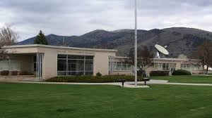
Morgan County is a county located in the state of Utah. Based on the 2010 census, the population was 9,469. Its county seat and largest city
is Morgan.
Morgan County is part of the Ogden-Clearfield, UT Metropolitan Statistical Area as well as the Salt Lake City-Provo-Orem, UT Combined
Statistical Area.
Etymology - Origin of Morgan County Name
The county was named for Jedediah Morgan Grant, father of Heber J. Grant, who served as president of The Church of Jesus Christ of Latter-day Saints.
Demographics:
County QuickFacts: CensusBureau Quick Facts
Morgan County History
Located in a high valley of the Wasatch Mountains, Morgan County is divided by the Weber River. The many streams that feed into the Weber made the valley attractive to fur trappers in the 1820s and to prehistoric Plains Indians and historic Shoshone and Ute Indians. In 1825, near present Mountain Green, trappers of the British Hudson's Bay Company under Peter Skene Ogden and competing American trappers came dangerously close to fighting, but Ogden kept the situation from becoming a major international incident.The city of Morgan was settled in 1855, and the county was created in 1862. During the Utah War (1857-58), settlers in Milton supplied feed for the horses of Mormon troops stationed in canyon passes watching for Johnston's Army. Lot Smith of Stoddard blocked Echo Canyon, buried US Army supply trains, and stampeded government horses and cattle. Despite such incidents, the "war" was settled peacefully.Morgan has a larger percentage of privately owned land than any other county in Utah. Much of it is used for stock raising, especially beef and dairy cattle and sheep, and for hay and other field crops. Lumber was a major industry during 1860-75 in Hardscrabble Canyon. Thousands of railroad ties were furnished to build the Union Pacific Railroad line, and charcoal was shipped to Bingham for use in smelting. During the building of the UP Railroad in 1868, a number of businesses opened in Morgan City and it became the county's trade center. Some say it was the only incorporated city on the UP line between Ogden and Omaha, Nebraska. In 1904 Morgan Canning Company was founded to can peas. The business grew and a second factory was built in Smithfield, Cache County. The company was sold to the California Packing Corporation in 1928. The manufacturing of Portland cement is a major local industry. This important industrial product has been produced at the Devil's Slide plant for more than 80 years. In addition to limestone - the main ingredient in cement - silver, lead, copper, coal, iron, sulphur, and mica have been found in Morgan, but most mining has been on a small scale. Agriculture, manufacturing, and trade do not provide enough jobs for residents, and in recent years more than half of those employed - the largest percentage in any county - have worked outside Morgan, mostly in the greater Ogden area. The county has benefited from the Weber Basin Reclamation Project. Beginning in 1952, federal funds were used to construct dams and power plants. The Lost Creek and East Canyon reservoirs are popular recreation sites.
*Sources: Beehive History 14: Utah Counties. 1988. Utah State Historical Society, 300 Rio Grande, Salt Lake City, UT 84101-1182.
Geography: Land and Water
As reported by the Census Bureau, the county has a total area of 611 square miles (1,582 km2), of which,
609 square miles (1,578 km2) of it is land and 2 square miles (4 km2) of it (0.27%) is water.
Neighboring Counties
Bordering counties are as follows:
- Weber County, Utah - (north)
- Summit County, Utah - (east)
- Salt Lake County, Utah - (southwest)
- Davis County, Utah - (west)
- Rich County, Utah - (northeast)
Education


Click Image to Enlarge
