


Click Image to Enlarge
Utah Counties
There are twenty-nine counties in the State of Utah. There were originally seven counties established under the provisional State of Deseret in 1849: Davis, Iron, Sanpete, Salt Lake, Tooele, Utah, and Weber. The Territory of Utah was created in 1851 with the first territorial legislature meeting from 1851-1852. The first legislature re-created the original counties from the State of Deseret under territorial law as well as establishing three additional counties: Juab, Millard, and Washington. All other counties were established between 1854 and 1894 by the Utah Territorial Legislature under territorial law except for the last two counties formed, Daggett and Duchesne.San Juan County, Utah
San Juan County Education, Geography, and History
San Juan County is a county located in the southeastern portion of the state of Utah. Based on the 2010 census, the population was 14,746.
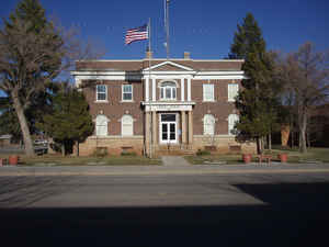
Its county seat is Monticello, while its most populous city is Blanding. The county was named by the Utah State Legislature for the San Juan
River.
San Juan County borders Arizona, Colorado, and New Mexico at the Four Corners.
Etymology - Origin of San Juan County Name
The county was named by the Utah State Legislature for the San Juan River, itself named by Spanish explorers (in honor of Saint John).
Demographics:
County QuickFacts: CensusBureau Quick Facts
San Juan County History
San Juan County is a part of the Colorado Plateau, a geologic region formed mostly of sandstone and limestone and including two-thirds of the state of Utah as well as parts of Colorado, New Mexico, and Arizona. Mighty rivers like the Colorado and the San Juan have carved deep canyons and unusual erosional forms through the colorful sedimentary rock, and many people find the area spectacularly beautiful on a grand scale.In prehistoric times the San Juan country was the home of the Anasazi until about 1300 A.D. Their cliff houses, pictographs, and petroglyphs continue to baffle and fascinate visitors. The Basketmakers, the earliest phase of the Anasazi Culture, were first identified and studied in Grand Gulch. The Navajo Indians, who were latecomers to the area, now occupy a large part of San Juan County from the San Juan River to the Arizona border. Although there were a few white residents along the San Juan River before 1879, the Mormon scouts who planned the famous Hole-in-the-Rock Trail that year began the full-scale settlement of San Juan County. The 180 pioneers who left Escalante in the fall of that year arrived at the present site of Bluff on April 6, 1880.Farming along the San Juan River bottoms was a chancy proposition, for the treacherous river either flooded or went dry too often for dependable irrigation. Early cattlemen like the brothers Al and Jim Scorup did better in the rough canyon country than the farmers. After a decade of fighting the elements many settlers discovered that life was somewhat easier in the high country around the Abajo Mountains, and the towns of Blanding and Monticello replaced Bluff as San Juan's main focal points.Mining has been an inconsistent but exciting part of the economy of the county. A gold rush on the San Juan River in the early l890s was short-lived, but miners in Glen Canyon of the Colorado eked a better living from deposits along the river bars. Oil and gas exploration around the turn of the century was productive, and one can still see wells operating along the San Juan River. The uranium boom of the early l950s brought large numbers of people into the area and created a few large fortunes.At present most residents see tourism as their most promising economic resource, particularly since the creation of Lake Powell in the early 1960s. Rainbow Bridge is the most popular tourist attraction in the county, but the marinas at Hite, Hall's Crossing, and Piute Farms draw large numbers of visitors, and river trips through Cataract Canyon and on the San Juan are also popular.
*Sources: Beehive History 14: Utah Counties. 1988. Utah State Historical Society, 300 Rio Grande, Salt Lake City, UT 84101-1182.
Geography: Land and Water
As reported by the Census Bureau, the county has a total area of 7,933 square miles (20,547 km2), of which
7,820 mi² (20,254 km2) is land and 113 mi² (292 km2) (1.42%) is water. There are roughly 2 residents per square
mile. The county's western and southern boundaries lie deep within gorges carved by the Colorado and San Juan
Rivers. Tributary canyons, cutting through rock layers of the surrounding deserts, have carved the land up with
chasms, cliffs and plateaus. In the center of the county are Cedar Mesa, Comb Wash, Natural Bridges and
Hovenweep National Monuments. Canyonlands National Park is primarily within the county borders. The Eastern side
of Glen Canyon National Recreation Area / Lake Powell in also in San Juan County. Rising above all, the Blue (Abajo)
Mountains reach to nearly 12,000 feet (3,700 m) and the La Sal Mountains rise to 13,000 feet (4,000 m). Both
ranges are covered with lush forests vividly contrasting with the scenery below. The elevation change within the
county is from near 13,000 feet (4,000 m) in the La Sal Mountains to 3,000 feet (910 m) at Lake Powell, an
elevation change of 10,000 feet (3,000 m). The county is cut by deep and spectacular canyons, red rock and
mountain meadows, desert, and evergreen forest. The towns run primarily on a north/south axis along US Highways
191 and 163 from La Sal in the north to Monument Valley in the south.
Neighboring Counties
Bordering counties are as follows:
- Grand County, Utah - (north)
- Montrose County, Colorado - (northeast)
- San Miguel County, Colorado - (east)
- Dolores County, Colorado - (east)
- Montezuma County, Colorado - (east)
- San Juan County, New Mexico - (southeast)
- Apache County, Arizona - (south)
- Navajo County, Arizona - (south)
- Coconino County, Arizona - (southwest)
- Kane County, Utah - (west)
- Garfield County, Utah - (west)
- Wayne County, Utah - (west)
- Emery County, Utah - (northwest)
Education


Click Image to Enlarge
