


Click Image to Enlarge
Utah Counties
There are twenty-nine counties in the State of Utah. There were originally seven counties established under the provisional State of Deseret in 1849: Davis, Iron, Sanpete, Salt Lake, Tooele, Utah, and Weber. The Territory of Utah was created in 1851 with the first territorial legislature meeting from 1851-1852. The first legislature re-created the original counties from the State of Deseret under territorial law as well as establishing three additional counties: Juab, Millard, and Washington. All other counties were established between 1854 and 1894 by the Utah Territorial Legislature under territorial law except for the last two counties formed, Daggett and Duchesne.Washington County, Utah
Washington County Education, Geography, and History
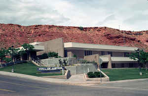
Washington County is a county located in the state of Utah. Based on the 2010 census, the population was 138,115, making it the fifth-most
populous county in Utah. Its county seat and largest city is St. George. The county was created in 1852 and organized in 1856. It was named
for the first President of the United States, George Washington.
Washington County comprises the St. George, UT Metropolitan Statistical Area.
Etymology - Origin of Washington County Name
It was named for the first President of the United States, George Washington.
Demographics:
County QuickFacts: CensusBureau Quick Facts
Washington County History
Washington County in the southwest
corner of the state is nicknamed Dixie because it includes a large area around
St. George, in the valley of the Virgin River and its tributaries, with the
highest average temperatures in the state and very mild winters. The eastern
third of the county, including spectacular Zion National Park, is part of the
Colorado Plateau. The western two-thirds lies in the Basin and Range geographic
province. The lowest point in the state, along Beaver Dam Wash (2,350 feet), is
near the county's southwest corner, while the Pine Valley Mountains in the north
top 10,000 feet.
Traces of the prehistoric Archaic and Anasazi cultures have been found in the
area, and the Santa Clara and Virgin rivers provided an important base for the
development of Southern Paiute life. The Dominguez-Escalante expedition in 1776
recorded the first description of the Indians in this area. In 1980 the federal
government restored traditional tribal lands west of Santa Clara to the Shivwits
branch of Southern Paiutes.
In an attempt to establish an overland route to the Pacific and southern
California (the so-called Mormon Corridor) the Mormons founded a string of
settlements running southwest from the Salt Lake Valley. Brigham Young sent
small groups into southwestern Utah as early as 1852 to test the agricultural
potential of the warm climate. Fort Harmony was established in 1852; Santa
Clara, 1854; Washington, 1857; Toquerville, 1858; Grafton, 1859; and Adventure
(Rockville), 1860. But until 1861--when several hundred families were called by
church leaders to go to the area to raise cotton, figs, olives, grapes, sugar,
almonds, and tobacco-colonization remained chiefly an experiment. St. George,
settled in 1861, became the center of Dixie, and the colonists succeeded in
producing sizable amounts of cotton, wine, and molasses. The demand for cotton
lasted until after the Civil War. The wine industry also grew during this
period, as did mining, but when mining decreased so did the demand for wine.
During 1875-80 Silver Reef, northwest of Leeds, was a booming mining town, and
Wells Fargo reportedly shipped more than $8,000,000 in bullion from the mines
there.
The boundaries of Washington County, formed in 1852 by the legislature,
stretched the entire width of the territory (then some 600 miles). After several
changes the county achieved its present size and shape in 1892.
The economic base of the county has changed significantly over the years from
its agricultural foundation to a much more diversified mix. Zion National Park
(established in 1909 as Mukuntuweap National Monument) has always been one of
the state's premier tourist attractions. The trade and service industries have
grown steadily to accommodate not only increasing numbers of tourists but also
the development of the area as a major retirement center. Communities such as
Bloomington, south of St. George and numerous condominiums and trailer parks
house thousands of winter residents. Two-year Dixie College with some 2,300
students is a major employer.
*Sources: Beehive History 14: Utah Counties. 1988. Utah State Historical Society, 300 Rio Grande, Salt Lake City, UT 84101-1182.
Geography: Land and Water
As reported by the Census Bureau, the county has a total area of 2,430 square miles (6,293 km2), of which,
2,427 square miles (6,285 km2) of it is land and 3 square miles (8 km2) of it (0.13%) is water. The elevation varies
from 2,178 to 10,194 feet in elevation
The county includes an area along the Old Spanish Trail called Mountain Meadows. Zion National Park is located in
the eastern part of Washington County.
Neighboring Counties
Bordering counties are as follows:
- Iron County, Utah - (north)
- Kane County, Utah - (east)
- Mohave County, Arizona - (south)
- Lincoln County, Nevada - (west)
Education
In addition to the primary and secondary schools that compose Washington County School District, Washington County is home to Dixie State University in St. George with a campus extension in Hurricane.


Click Image to Enlarge
