


Click Image to Enlarge
Utah Counties
There are twenty-nine counties in the State of Utah. There were originally seven counties established under the provisional State of Deseret in 1849: Davis, Iron, Sanpete, Salt Lake, Tooele, Utah, and Weber. The Territory of Utah was created in 1851 with the first territorial legislature meeting from 1851-1852. The first legislature re-created the original counties from the State of Deseret under territorial law as well as establishing three additional counties: Juab, Millard, and Washington. All other counties were established between 1854 and 1894 by the Utah Territorial Legislature under territorial law except for the last two counties formed, Daggett and Duchesne.Wayne County, Utah
Wayne County Education, Geography, and History
Wayne County is a county located in the state of Utah. Based on the 2010 census, the population was 2,778, making it the fourth-least populous county in Utah. Its county seat is Loa. The county was formed from Piute County in 1892
Etymology - Origin of Wayne County Name
Wayne Robinson, the son of Utah state legislator Willis Robinson, who was killed by a horse while both men traveled to a legislative session.
Demographics:
County QuickFacts: CensusBureau Quick Facts
Wayne County History
Wayne County lies entirely within the
colorful Colorado Plateau geographical province and includes portions of Capitol
Reef and Canyonlands National Parks. The Fremont River flows south into the
county from Fish Lake and then east to join the Dirty Devil, a tributary of the
Green River. The Green marks the county's eastern border.
Scientists have identified the remains of extinct Pleistocene species such as
the sloth, horse, mammoth, bison, and camel in Wayne and dated Archaic and
Fremont Indian sites (Cowboy Caves) to between 6300 B.C. and 450 A.D. Horseshoe
(Barrier) Canyon and the Maze section of Canyonlands in eastern Wayne contain
spectacular pictographs. In historic times the county was part of the Ute
Indians' domain.
Wayne was created in May 1892 from Piute County. Most of its towns were settled
after 1880 because of the remote location and limited resources. Raising
livestock is the oldest and most important industry. Beef cattle produce the
most income, but dairy cows, sheep, and poultry have all contributed to the
local economy in the past. Getting cattle to market was difficult. Until good
roads were built in the 1930s stock was driven some 100 miles north to the
railroad at Nephi and later to a Denver & Rio Grande branch line in Sevier
County. The creation of national forests in the early 20th century reduced the
number of cattle that could be grazed in western Wayne County, and cattle
rustling by the notorious Robbers Roost gang threatened ranchers until the late
1890s. The lumber industry and, in more recent years, tourism also provide
income for some residents. Uranium has been mined, and tar sands, another
energy-related resource, await development. The state operates two fish
hatcheries in Wayne.
During the Great Depression the Works Progress Administration (WPA) provided
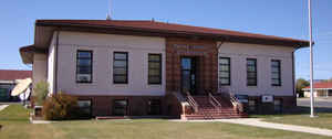
funds to build a county courthouse in Loa. County officials originally met in
private homes and rented quarters and later converted a store into office space.
The Civilian Conservation Corps (CCC), another federal program during the
depression, operated three camps in the county. The CCC built roads,
campgrounds, and small water projects. Road building has been a major concern of
local government from the beginning. Modern highways now make it easy for
tourists to drive to many scenic attractions and give residents easy access to
the nearest commercial center and medical and other services in Richfield.
*Sources: Beehive History 14: Utah Counties. 1988. Utah State Historical
Society, 300 Rio Grande, Salt Lake City, UT 84101-1182.
Geography: Land and Water
As reported by the Census Bureau, the county has a total area of 2,466 square miles (6,388 km2), of which,
2,460 square miles (6,372 km2) of it is land and 6 square miles (16 km2) of it (0.25%) is water. The Green River,
passing through the canyons of Canyonlands National Park, forms the eastern boundary. The San Rafael Desert occupies
the center of the county. Thousand Lake Mountain and Boulder Mountain flank Rabbit Valley on the western end of the
county, where beautiful forests contrast with the deserts to the east. The small population of the county is
centered in Rabbit Valley. With one town of 200, Hanksville, located in Graves Valley North of the Henry Mountains.
The name of the county did indeed derive from Wayne Robison not Robinson son of Willis Robison. Wayne County is also
home of Capitol Reef National Park
Neighboring Counties
Bordering counties are as follows:
- Emery County, Utah - (north-central & east)
- Garfield County, Utah - (south)
- Piute County, Utah - (west)
- San Juan County, Utah - (east)
- Sevier County, Utah - (north-west)
Education


Click Image to Enlarge
