


Click Image to Enlarge
California Counties
The state of California is divided into fifty-eight counties. On January 4, 1850, the California constitutional committee recommended the formation of 18 counties. They were Benicia, Butte, Fremont, Los Angeles, Mariposa, Monterey, Mount Diablo, Oro, Redding, Sacramento, San Diego, San Francisco, San Joaquin, San Jose, San Luis Obispo, Santa Barbara, Sonoma, and Sutter. The last California county to have been established is Imperial County in 1907.Colusa County, California
Colusa County Education, Geography, and History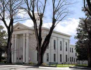
Colusa County is a county located in the state of California. Based on the 2010 census, the population was 21,419. The county seat is Colusa and is located in the Central Valley of California, northwest of the state capital, Sacramento. Colusa County was created on February 18, 1850. The county is named after two Mexican land grants, Coluses (1844) and Colus (1845).
Etymology - Origin of Colusa County Name
Named after two Mexican land grants; Coluses (1844) and Colus (1845). The name of the county in the original state legislative act was spelled Colusi, and often in newspapers was spelled Coluse. The word is derived from the name of an Indian tribe living on the west side of the Sacramento River.
Demographics:
County QuickFacts: CensusBureau Quick Facts
Colusa County History
Colusi County existed as a legal entity for only a few years after its creation in 1850. It was named after two
Mexican land grants; Coluses (1844) and Colus (1845). The name of the county in the original state legislative act was
spelled Colusi, and often in newspapers was spelled Coluse. The word is derived from the name of an Indian tribe living
on the west side of the Sacramento River. Its name soon changed. Colusi became Colusa on legal documents in 1854 when
the county seat moved from Monroeville to Colusa. Two years later the upper third of its territory, along with land from
Shasta County on the north, and Butte County on the east, became Tehama County. Red Bluff soon replaced Tehama as the
county seat. In 1891, the northern half of Colusa County became Glenn County with Willows as its seat of county
government.
American settlement in Colusi-land began very slowly in the 1840's under Mexican rule. The
masses attracted by the
discovery of gold bypassed this area. As the work of mining gold increased,
dissatisfied miners sought other means of
support. Some came to old Colusi and took up land along the River or in the foothills of the Coast Range Mountains.
Small farms and ranches became common. Settlements became towns. The raising of cattle and sheep gave way to fields of
barley and wheat. Steamboats on the Sacramento River brought cargo and passengers to Colusa. Oxen or mule drawn wagons
carried supplies and food from there to the mines of Shasta and Trinity Counties.
In 1875, the railroad began its slow advance from Woodland up the treeless, grassy plains, about halfway between the
foothills of the Coast Range Mountains and the Sacramento River. It took a half dozen years to reach Red Bluff. As it
progressed, it started towns: Arbuckle, Williams, Maxwell, Willows and Orland.
The railroad brought people. Civil War veterans of both the Union and the Confederacy, immigrants from Europe and
families from the Mid-west came and found a home in the land of Colusi. Often they purchased a small farm or orchard:
almonds in Arbuckle, oranges in Orland, prunes in Colusa, or olives in Corning. Farming changed. Rice and tomatoes
surpassed the production of cattle and wheat.
Geography: Land and Water
As reported by the Census Bureau, the county has a total area of 1,156 square miles (2,995 km2), of which, 1,151 square miles (2,980 km2) of it is land and 6 square miles (14 km2) of it (0.48%) is water.
A large number of streams drain the county including Elk Creek and Salt Creek.
The county's eastern boundary is formed, in part, by the Sacramento River. The area that once was Colusi shares at least three common geographical features, all traversing the three counties in a
north to south direction: the Coast Range Mountains on the west, flat plains in the middle and the Sacramento River on
the east. During the past two to three thousand years, its waters has sustained the lives of those, both ancient and
contemporary, living along its banks. The River gives humans water to drink and food to eat. It even allows them to swim
or to boat upon its surface. For about fifty years, from 1850 to 1900, men, in their steamboats, used it as the major
means of transportation.
The River has a Jekyll and Hyde life of its own. It changes with the seasons from a gentle life-sustaining friend of
summer and fall to a life taking fiendish flood of winter and spring. Despite the expertise and technology of modernism,
its sometimes-uncontrollable rampages still invoke fear and cause catastrophic losses.
Neighboring Counties
Bordering counties are as follows:
- Northeast: Butte County
- Southeast: Sutter County; Yolo County
- West: Lake County
- Northwest: Glenn County
Education


Click Image to Enlarge
