


Click Image to Enlarge
California Counties
The state of California is divided into fifty-eight counties. On January 4, 1850, the California constitutional committee recommended the formation of 18 counties. They were Benicia, Butte, Fremont, Los Angeles, Mariposa, Monterey, Mount Diablo, Oro, Redding, Sacramento, San Diego, San Francisco, San Joaquin, San Jose, San Luis Obispo, Santa Barbara, Sonoma, and Sutter. The last California county to have been established is Imperial County in 1907.Kern County, California
Kern County Education, Geography, and History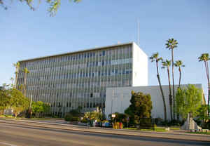
Kern County is a county located in the state of California. Based on the 2010 census, the
population was 839,631. The county
seat is
Bakersfield. Kern County was formed on April 2, 1866
from Tulare County and Los Angeles County. This county is named
from the Kern River, which is named for Edward Kern, topographer of
General John C. Fremont's 1845 expedition.
Kern County comprises the Bakersfield, CA Metropolitan Statistical Area.
Etymology - Origin of Kern County Name
The county is named for the Kern River which was named for Edward Kern, cartographer for General John C. Fremont's 1845 expedition, which crossed Walker Pass. The Kern River was originally named Rio Bravo de San Felipe by Father Francisco Garces when he explored the area in 1776.
Demographics:
County QuickFacts: CensusBureau Quick Facts
Kern County History
The Kern County area was first claimed by the Spanish in 1769. In 1772, Commander Don Pedro Fages became the first
European to arrive in the area. The expedition entered via the Grapevine Canyon (later the site of the Ridge Route along
US 99 and now Interstate 5). Walker Pass was discovered in 1834 and is an important pass across the Sierra Nevada as
it is one of the few not closed by winter snows. It is now a National Historic Landmark. In 1848, the Kern area was
ceded to the United States as part of the transfer of California, Nevada, and Utah and other lands under the Treaty of
Guadalupe Hidalgo.
The Havilah Court building was restored in the 1970s and now serves as a museum. Kern County was created in 1866
from parts of Los Angeles and Tulare Counties with the county seat located in the now abandoned mining town of Havilah.
In its beginning, Kern County was controlled by mining in the mountains and desert. The area of the San Joaquin Valley
was considered unwelcoming and impassable at the time due to swamps, lakes, tule reeds, and diseases such as malaria.
This changed when settlers started draining lands for farming and constructing canals, most dug by hand by hired Chinese
laborers, to irrigate and drain these lands. Within 10 years the area of the San Joaquin Valley surpassed the mining
areas as the economic influence of the county, and the county seat was moved from Havilah to Bakersfield in 1874.
Geography: Land and Water
As reported by the Census Bureau, the county has a total area of 8,161 square miles (21,138 km2), of which, 8,141 square miles (21,085 km2) of it is land and 20 square miles (53 km2) of it (0.25%) is water. It is the third largest county by area in California.
Kern county is home to an astonishing selection of geography: ranging
from the wide-open Central Valley to the peaceful Sierra Nevada
Mountains to the striking terrain of the Mojave Desert.
Neighboring Counties
Bordering counties are as follows:
- North: Tulare County
- Northeast: Inyo County
- East: San Bernardino County
- Southeast: Los Angeles County
- Southwest: Ventura County; Santa Barbara County
- West: San Luis Obispo County
- Northwest: Monterey County; Kings County
Education


Click Image to Enlarge
