


Click Image to Enlarge
California Counties
The state of California is divided into fifty-eight counties. On January 4, 1850, the California constitutional committee recommended the formation of 18 counties. They were Benicia, Butte, Fremont, Los Angeles, Mariposa, Monterey, Mount Diablo, Oro, Redding, Sacramento, San Diego, San Francisco, San Joaquin, San Jose, San Luis Obispo, Santa Barbara, Sonoma, and Sutter. The last California county to have been established is Imperial County in 1907.Merced County, California
Merced County Education, Geography, and History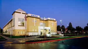
Merced County , is a county located in the Central Valley of the state of California. Based on the 2010 census, the
population was
255,793. The county seat is Merced.
Merced county was created on April 19, 1855, from a
part of Mariposa County. The county is named after the Merced River.
Merced County comprises the Merced, CA Metropolitan Statistical Area, which is included in the Modesto-Merced, CA Combined Statistical
Area. It is located north of Fresno and southeast of San Jose.
Etymology - Origin of Merced County Name
The county derived its name from the Merced River of El Rio de Nuestra Senora de la Merced (River of Our Lady of Mercy); named in 1806 by an expedition, headed by Gabriel Moraga, which came upon it at the end of a hot dusty ride.
Demographics:
County QuickFacts: CensusBureau Quick Facts
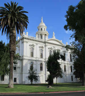
Merced County History
Merced County was formed in 1855 from parts of Mariposa County. Parts of its territory were given to Fresno County in 1856.
Merced County was created by the Act of April 19, 1855, organized by an election held May 14 and the votes of which were canvassed May 19, and that the first board of supervisors held their first meeting at the Turner & Osborn Ranch on June 4. It is a matter of history that Stanislaus County was formed in 1854, and it is also a matter of history that an attempt was made- and failed- to include the settlements along the Merced in that county. These settlements apparently that early had a awareness of being a separate unit. The census of 1850 gave Mariposa County 4379, and that was for the county which extended from the Coast Range to the State's eastern boundary, and from approximately the present northern line of Mariposa and Merced to the vicinity of San Bernardino. The 1860 census gave a greatly reduced Mariposa County 6243. Tulare, Merced, and Fresno had been carved off before 1860; and this figure is the highest which any federal census gives to Mariposa. It is probable that her greatest population, some time in between these two censuses, must have exceeded the 1860 figure, and exceeded it a good deal. Old timers will tell you that there were 5000 people in Agua Fria and its twin town of Carson City when these mushroom towns were in their brief prime
Geography: Land and Water
As reported by the Census Bureau, the county has a total area of 1,972 square miles (5,107 km2), of which, 1,929 square miles (4,995 km2) of it is land and 43 square miles (112 km2) of it (2.19%) is water.
The Merced River in this area is a grass bordered river with
trees and brush. The river's broad, sweeping canyon is home to oak
and pine trees and grand grassy hills. In the spring, golden
poppies, purple lupine and fragrant wild irises burst in color on
the green hillsides.
Neighboring Counties
Bordering counties are as follows:
- Northeast: Tuolumne County; Mariposa County
- East: Madera County
- Southeast: Fresno County
- Southwest: San Benito County
- West: Santa Clara County
- Northwest: Stanislaus County
Education


Click Image to Enlarge
