


Click Image to Enlarge
California Counties
The state of California is divided into fifty-eight counties. On January 4, 1850, the California constitutional committee recommended the formation of 18 counties. They were Benicia, Butte, Fremont, Los Angeles, Mariposa, Monterey, Mount Diablo, Oro, Redding, Sacramento, San Diego, San Francisco, San Joaquin, San Jose, San Luis Obispo, Santa Barbara, Sonoma, and Sutter. The last California county to have been established is Imperial County in 1907.Santa Barbara County, California
Santa Barbara County Education, Geography, and History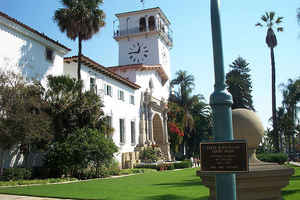
Santa Barbara County, California, officially the County of Santa Barbara, is a county located in the southern portion of the state of
California. Based on the 2010 census, the population was 423,895. The
county seat is Santa Barbara, and the largest city is Santa Maria.
The county was created February 18, 1850. The Santa
Barbara Channel received its name from Sebastian Vizcaino when he sailed
over the channel waters in 1602. December 4, 1786, he founded the nearby
Mission Santa Barbara (Saint Barbara). The county derives
its name from the mission.
Santa Barbara County comprises the Santa Maria-Santa Barbara, CA Metropolitan Statistical Area.
Etymology - Origin of Santa Barbara County Name
The Santa Barbara Channel received its name from Sebastian Vizcaino when he sailed over the channel waters in 1602. In 1782, Padre Junipero Serra dedicated a site near the channel for a presidio and on Dec. 4, 1786, he founded the nearby Mission Santa Barbara (Saint Barbara). The county derives its name from the mission.
Demographics:
County QuickFacts: CensusBureau Quick Facts
Santa Barbara County History
Santa Barbara County is a county located on the Pacific coast of the southern portion of the US
state of California, just west of Ventura County. The county seat is Santa Barbara, and the largest city
is Santa Maria.
In 1848 Mexico signed a treaty ceding California to the United States. The territory became a state in 1850 when the population exploded to nearly 100,000 with the discovery of gold. While California was still a territory, county boundaries were formed. The present county of Ventura was originally included within Santa Barbara County until 1873 when the Legislature separated the area into the present Ventura and Santa Barbara Counties.
Santa Barbara County
http://www.cagenweb.com/santabarbara/sbarhist.htm
Geography: Land and Water
As reported by the Census Bureau, the county has a total area of 3,789 square miles (9,814 km2), of which, 2,737 square miles (7,089 km2) of it is land and 1,052 square miles (2,725 km2) of it (27.77%) is water.
The Santa Ynez River and its tributaries drain the rugged and
picturesque Santa Ynez Mountains north of Santa Barbara. The 25
mile-long upper Santa Ynez River is the longest stretch of free flowing
river.
Neighboring Counties
Bordering counties are as follows:
- Northeast: Kern County
- East: Ventura County
- Southwest: North Pacific Ocean
- Northwest: San Luis Obispo County
Education
There are 20 independent school districts in Santa Barbara County, and the Santa Barbara County Education Office serves as an intermediate
agency between those districts and the California Department of Education. During the 2013 school year, 67,701 students were enrolled in Santa
Barbara County schools, kindergarten through grade 12.
There are also a number of private schools in the county. The Los Angeles Archdiocese operates two Catholic high schools and several
elementary schools.


Click Image to Enlarge
