


Click Image to Enlarge
California Counties
The state of California is divided into fifty-eight counties. On January 4, 1850, the California constitutional committee recommended the formation of 18 counties. They were Benicia, Butte, Fremont, Los Angeles, Mariposa, Monterey, Mount Diablo, Oro, Redding, Sacramento, San Diego, San Francisco, San Joaquin, San Jose, San Luis Obispo, Santa Barbara, Sonoma, and Sutter. The last California county to have been established is Imperial County in 1907.Sutter County, California
Sutter County Education, Geography, and History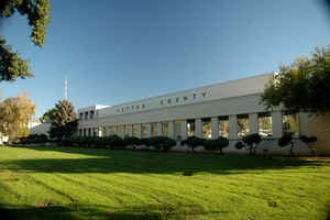
Sutter County is a county in the state of California. Based on the 2010 census, the
population was 94,737. The county
seat is Yuba City. The county was created
February 18, 1850. Sutter County was named after
General John Augustus Sutter, a native of Switzerland.
Sutter County is included in the Yuba City, CA Metropolitan Statistical Area as well as the Sacramento-Roseville, CA Combined Statistical
Area. The county is located along the Sacramento River in the Sacramento Valley.
Etymology - Origin of Sutter County Name
Sutter County was named after General John Augustus Sutter, a native of Switzerland, who obtained a large land grant from the Mexican government and called his first settlement New Helvetia (now the City of Sacramento). In 1841, the general established a great stock ranch in this area to which he retired in 1850 when gold seekers deprived him of most of his holdings at Sacramento.
Demographics:
County QuickFacts: CensusBureau Quick Facts
Sutter County History
Sutter County was one of the original counties of California, created in 1850 at the time of statehood. Shares of the county were given to Placer County in 1851.
In the early 1800's, the area now known as Sutter County was inhabited by the native Maidu Indians. Members of various Spanish expeditions in search of mission sites, and fur trappers lured by the plentiful wildlife, traveled through in 1841. Most of the territory was deeded by the Mexican Government to the County's namesake, John Sutter. Established in 1842, John Sutter's Hock Farm was the first large-scale agricultural settlement in Northern California, composed of grain, cattle, orchards and vineyards.
Geography: Land and Water
As reported by the Census Bureau, the county has a total area of 609 square miles (1,576 km2), of
which, 603 square miles (1,561 km2) of it is land and 6 square miles (16 km2) of it (0.99%) is water.
Sutter County is home to the Sutter Buttes, known as the "World's Smallest Mountain Range." This
volcanic formation provides a break to the seemingly flat Sacramento Valley.
Neighboring Counties
Bordering counties are as follows:
- North: Butte County
- Northeast: Yuba County
- East: Placer County
- Southeast: Sacramento County
- Southwest: Yolo County
- Northwest: Colusa County


Click Image to Enlarge
