

Click Image to Enlarge
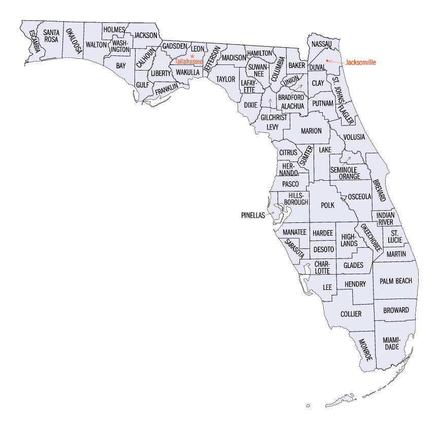
Florida Counties
There are sixty-seven counties in the state of Florida. In 1821, there were only two Counties in Florida: Escambia to the west and St. Johns to the east. From these two Counties were formed 67 today. Its last county was created in 1925 with the formation of Gilchrist County from a segment of Alachua County.Clay County, Florida
Clay County Education, Geography, and History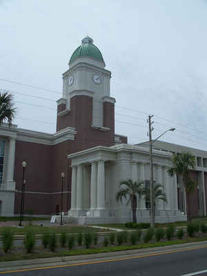
Clay County is a county located in the state of Florida. Based on the 2010 census, the
population was 190,895. Clay County was created
on December 31, 1858 from Duval County. The county
seat is Green Cove Springs, Florida. This county is named
for Henry Clay (1777-1852), Secretary of State from 1825 to 1829 under
John Quincy Adams.
Clay County is included in the Jacksonville, FL Metropolitan Statistical Area.
Etymology - Origin of Clay County Name
The county name is in honor of Henry Clay, famous American statesman, member of the United States Senate from Kentucky and United States Secretary of State in the 19th century.
Demographics:
County QuickFacts: CensusBureau Quick Facts
Clay County History
Once a part of Duval County (Jacksonville), Clay County was carved out on December 31, 1858. The
county consists of our incorporated municipalities: Orange Park, Green Cove Springs, Penney Farms, and Keystone Heights,
as well as one unincorporated municipality, Middleburg.
Both regional and national wars greatly impacted life in Clay County. When fighting erupted with the Seminoles in
December 1835, Garey's Ferry (the site of present-day Middleburg) was chosen as a supply depot for the US Army on
Florida's east coast. In 1836, Ft. Heileman was established and Gary's Ferry was one of the few Florida frontier towns
not abandoned during the 2nd Seminole War. As the Civil War was nearing its end, Clay County saw its first battle. In
mid-1864, Union forces established a fort at Magnolia Springs on the St. Johns River where they could send troops to
apply pressure to Confederate forces located within the county. While Union troops were returning from a successful raid
on Middleburg, Confederate forces under the command of Capt. J.J. Dickinson engaged the Union troops and inflicted heavy
casualties. The battle lasted 45 minutes with no casualties among the Confederate troops.
After the Civil War, tourism became a vital part of Clay County life. Northerners were drawn to natural springs that
promised healing and warm winter climates that offered respite from frigid northern winters. The tourists were delighted
by the exotic wildlife and vegetation found along the banks of the creeks and rivers. Dozens of hotels were built to
accommodate the visitors who came by steamboat. Hotels such as the St. Elmo, Magonlia Springs, Clarendon, and the
Oakland Hotels invited tourists to rest and relax in the sunny climate of Florida. Families along the St. Johns River,
such as the Flemings, opened their plantation homes to northern visitors. Among the visitors to Clay County were such
famous people as Ulysses S. Grant, President Grover Cleveland (who had spring water shipped to the White House), Buffalo
Bill, and Sitting Bull. The height of tourism in Clay County spanned three decades, from the 1870's to the early 1900's.
Tourism in Clay County went into decline when Henry Flagler's railroad reached Miami, and south Florida was easily
accessible.
Geography: Land and Water
As reported by the Census Bureau, the county has a total area of 644 square miles (1,667 km2), of which, 601 square miles (1,557 km2) of it is land and 43 square miles (110 km2) of it (6.62%) is water.
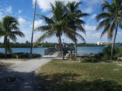
Clay county is located close to the center of Florida. Clay County,
Florida, rich in natural beauty and history, is a water wonderland,
where lakes and rivers are in abundance. With its entire eastern
boundary defined by the north-flowing St. Johns River it is no wonder
that the scenery is captivating.
Neighboring Counties
Bordering counties are as follows:
- Northeast: Duval County
- East: St. Johns County
- Southeast: Putnam County
- Southwest: Alachua County
- West: Bradford County
- Northwest: Baker County
Education
The Clay County School District operates 42 public schools. There are currently 28 elementary schools, 6 junior high schools, and 8 high schools.


Click Image to Enlarge
