


Click Image to Enlarge
Kansas Counties
Kansas has one hundred and five counties. Originally 33 counties were organized by the Territorial Legislature in 1855. The Chase County Courthouse in Cottonwood Falls, Kansas was built in 1873 and is the oldest operating courthouse in Kansas. As of January 1, 2009 Greeley County and the city of Tribune unified to form the Unified Government of Greeley County..Geary County, Kansas
Geary County Education, Geography, and History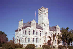
Geary County is a county located in the state of Kansas. Based on the 2010 census, the county
population was 34,362. Davis County was created
on August 30, 1855 named for Jefferson Davis, on March 07, 1889 the name
changed to Geary County The county seat and most populous city is Junction City. The county is
named in honor of Governor John W. Geary.
Geary County comprises the Junction City, KS Micropolitan Statistical Area, which is included in the Manhattan-Junction City, KS Combined
Statistical Area.
Etymology - Origin of Geary County Name
The county was organized in 1855 as Davis County, which was named for Jefferson Davis--United States Senator and Secretary of war--who became President of the Southern Confederacy. The Legislature changed the name to Geary in 1869, in honor of John W. Geary, who was Territorial Governor of Kansas from 1856 until March, 1857. County seat, Junction City.
Demographics:
County QuickFacts: CensusBureau Quick Facts
Geary County History
Geary County, originally called Davis, is located in the northeastern part of the state, being in the third tier of counties south of Nebraska and in the fifth west from the Missouri river. It is bounded on the north by Riley county, east by Riley and Wabaunsee, south by Morris and Dickinson, and west by Dickinson and Clay. It is irregular in shape, contains 407 square miles, and is one of the 33 counties created by an act of the first territorial legislature in 1855 it was organized at the time of its creation and named "Davis" in honor of Jefferson Davis, who was at that time secretary of war. By act of the Kansas legislature of Feb. 28, 1889, the name was changed to Geary, in honor of John White Geary, third territorial governor of Kansas. An attempt was made by the act of March 11, 1893, to change the name back to Davis, provided a majority of the people of the county favored the proposition, but the majority was against the change and the name Geary remains.
Geography: Land and Water
As reported by the Census Bureau, the county has a total area of 404 square miles (1,050 km2), of which 385 square miles (1,000 km2) is land and 20 square miles (52 km2) (4.9%) is water.
Geary county is located in east Kansas. This county is the second smallest county in Kansas by land area and third-smallest by total area. The east and central parts of the county are rough and hilly along the streams but the southeastern and western parts are rolling prairie. The county is well watered by the Republican and Smoky Hill rivers, which join near Junction City to form the Kansas river.
Neighboring Counties
Bordering counties are as follows:
- Riley County (north)
- Wabaunsee County (east)
- Morris County (south)
- Dickinson County (west)
- Clay County (northwest)
Education
Unified School Districts
Geary County USD 475


Click Image to Enlarge
