


Click Image to Enlarge
Kansas Counties
Kansas has one hundred and five counties. Originally 33 counties were organized by the Territorial Legislature in 1855. The Chase County Courthouse in Cottonwood Falls, Kansas was built in 1873 and is the oldest operating courthouse in Kansas. As of January 1, 2009 Greeley County and the city of Tribune unified to form the Unified Government of Greeley County..Gray County, Kansas
Gray County Education, Geography, and History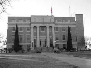
Gray County is a county located in the state of Kansas. Based on the 2010 census, the county population was 6,006. Gray County was created on March 13, 1881. The county seat and most populous city is Cimarron. The county is named in honor of Alfred Gray (1830-1880), secretary of the Kansas Board of Agriculture.
Etymology - Origin of Gray County Name
The county is named in honor of Alfred Gray, late Secretary of the State Board of Agriculture.
Demographics:
County QuickFacts: CensusBureau Quick Facts
Gray County History
Gray County, located in the southwestern part of the state, is the second county north from the Oklahoma line, and the fourth east from Colorado. It is bounded on the north by Finney county, on the east by Hodgeman and Ford counties, on the south by Meade, and on the west by Haskell and Finney.
Practically the same territory that now constitutes it was described by the legislature of 1879 as Foote county. In 1881 an act was passed creating and bounding Gray county as follows: "Commencing at a point where the east line of range 27 west crosses the south line of township 21 south; thence
west on said south line of said township to where said line crosses the west line of range 30 west; thence south on said west line of range 30 west to the south line of township 28 south; thence east on said south line of township 28 south to the east line of range 27 west; thence north on said east
line of range 27 west to the place of beginning."
In 1887 it was bounded as follows: "Commencing at the intersection of the east line of range 27 west with the north line of township 24 south; thence south along range line to its intersection with the north line of township 30 south; thence west along township line to where it intersects the east
line of range 31 west; thence north along range line to its intersection with the north line of township 24 south; thence east to the place of beginning."
Since 2001, Next Era Energy Resources has operated the largest wind farm in Kansas - 170 turbines with a generating capacity of 110 megawatts - on a 12,000-acre (49 km2) site near Montezuma.
Geography: Land and Water
As reported by the Census Bureau, the county has a total area of 869 square miles (2,250 km2), of which 869 square miles (2,250 km2) is
land and 0.4 square miles (1.0 km2) (0.05%) is water.
Gray county is located in west Kansas. The county is rolling prairie. The Arkansas river crosses it in a southeasterly direction.
Description
The Arkansas River has carved a huge valley across the county. Inside this valley, the landscape is rugged, but by going north or south you climb out onto flat plains. The river bed is sandy and lined with cottonwoods, but it is often dry. It's hard now to imagine building an irrigation canal from it, but the river was much larger a century ago.
Neighboring Counties
Bordering counties are as follows:
- Finney County (north)
- Hodgeman County (northeast)
- Ford County (east)
- Meade County (south)
- Haskell County (west)
Education
Unified School Districts
Cimarron-Ensign USD 102
Montezuma USD 371
Copeland USD 476
Ingalls USD 477


Click Image to Enlarge
