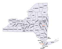
New York Counties
There are sixty-two counties in the State of New York. The first twelve counties in New York were created immediately after the British annexation of the Dutch colony of New Amsterdam, although two of these counties have since been abolished. The most recent county formation in New York was in 1912, when Bronx County was created from the portions of New York City that had been annexed from Westchester County.Onondaga County, New York
Onondaga County Education, Geography, and History
Onondaga County is a county located in the state of New York. Based on the 2010 census, the population was
467,026. The county seat is Syracuse.
Onondaga County is part of the Syracuse, NY Metropolitan Statistical Area.
Etymology - Origin of Onondaga County Name
Named in honor of an Indian tribe of the Iroquois League
Demographics:
County QuickFacts: CensusBureau Quick Facts
Onondaga County History
Onondaga County was taken from Herkimer in 1794; bounds since altered by the formation of other counties from it. Greatest length N. and S. 36, greatest breadth E. and W. 28 miles. Centrally distant from New York 280 miles, from Albany 135 miles. This county, though not extensive, embraces a most important portion of the territory of this state. Here are the salt springs, an inexhaustible source of immense wealth; beds of gypsum or plaster, of vast extent, hydraulic lime, and common limestone. Surface is diversified. The northern portion of the county is level; the centre and southern rolling, and rising in some places into hills. The soil is generally good, and in some portions excellent, and under high cultivation. Large crops of wheat and Indian corn are annually raised. Both are greatly aided by the use of plaster. The principal lakes are Oneida, Skaneateles, Onondaga, and Otisco. The Rome summit, or long level of the Erie canal, 69~- miles in length, has its western extremity near Syracuse. The county forms part of the military tract, and settlements were first made here in the spring of 1788, while composing part of Whitestown, Oneida county. The county is divided into 18 towns, of which Lysander, Manlius, Marcellus, Onondaga, and Pompey were organized by general sessions in 1789. (Historical Collections of the State of New York, Past and Present, John Barber, Clark Albien & Co., 1851)
Onondaga County is at the heart of New York State - the crossroads where the major east-west and north-south
routes of the Eastern United States intersect. From the earliest days when the Onondagas were responsible for the
council fire at the center of the Iroquois confederacy, Onondaga County has been the focus of transportation and
commerce.
Geography: Land and Water
Onondaga County is in the west central portion of New York State, west of Utica, east of Rochester and north of
Ithaca. As reported by the Census Bureau, the county has a total area of 806 square miles (2,087 km2), of which,
780 square miles (2,021 km2) of it is land and 25 square miles (66 km2) of it (3.15%) is water. Onondaga Lake is
bordered by many of the larger communities in the county.
The northern part of the county is fairly level lake plain, extending northward to Lake Ontario. Oneida Lake three
rivers, as well as the Erie and subsequent Barge Canals are in the lake plain. The main line of the New York Central
Railroad and the New York State Thruway extend east and west across the county through the lake plain. The southern
part of the county is Appalachian Plateau, with high hills rising at the southern edge of Syracuse. This is the
eastern part of the Finger Lakes region. Skaneateles Lake and Otisco Lake are both in Onondaga County. US 20 extends
east and west across the county, traversing dramatic hill-and-valley terrain. Between the lake plain and Appalachian
highlands is a zone noted for drumlins, smaller, scattered hills formed as mounds of debris left by the last
glacier. Tully is geologically noted for the terminal moraine deposited there by the glacier, filling the deep Tully
Valley, which might have been another Finger Lake, had the moraine been left closer to Syracuse, impounding water.
Tully is at the divide between two major watersheds, one flowing northward to the Atlantic Ocean by way of the St.
Lawrence River and the other southward to the ocean vie the Susquehanna River. Onieda Lake, the Finger Lakes, and
smaller bodies of water provide recreation. Several ski slopes are located in the Appalachian hills, where there are
waterfalls and historic villages as attractions, as well as parks and large forest preserves.
Neighboring Counties
Bordering counties are as follows:
- Oswego County, New York - north
- Madison County, New York - east
- Cortland County, New York - south
Cayuga County, New York - west
Education


