


Click Image to Enlarge
New York Counties
There are sixty-two counties in the State of New York. The first twelve counties in New York were created immediately after the British annexation of the Dutch colony of New Amsterdam, although two of these counties have since been abolished. The most recent county formation in New York was in 1912, when Bronx County was created from the portions of New York City that had been annexed from Westchester County.Ulster County, New York
Ulster County Education, Geography, and History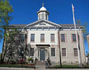
Ulster County is a county located in the state of New York. Based on the 2010 census, the population was 182,493. The county seat is
Kingston. The county is named for the Irish province of Ulster.
Ulster County comprises the Kingston, NY Metropolitan Statistical Area, which is also included in the New York-Newark, NY-NJ-CT-PA Combined
Statistical Area. It is located in the state's Mid-Hudson Region of the Hudson Valley
Etymology - Origin of Ulster County Name
Named for the Duke of York's earldom in Ireland
Demographics:
County QuickFacts: CensusBureau Quick Facts
Ulster County History
Ulster County, an original county, was organized in 1683. It is from New York centrally distant N. 110, and from
Albany S. 60 miles. Greatest length E. and W. 50, breadth N. and S. 40 miles. The face of the country is mountainous.
The Shawangunk mountain enters the county from Orange, and running NE nearly 30 miles, sinks into low and irregular
hills in Hurley; but its continuity is preserved to Kingston near the Hudson. Northward of that village it again rises,
until it is
identified with the Catskill mountains. Between the Blue and Shawangunk mountains is a broad valley through which winds
the Rondout river, a stream whose name is a corruption of the word Redoubt, so named after a fortification built upon
the stream by the early Dutch settlers. The Wallkill runs a northeast course south of the Shawangunk mountain, receiving
the Shawangunk creek, and uniting with the Rondout, 8 miles from its mouth. trhe three streams above noticed are the
great drains of the county, and afford very advantageous mill power, within a few miles of the tide, much of which is
yet unemployed. In the west the Nevisink river and other tributaries of the Delaware have their sources. The Delaware
and Hudson canal enters the county at its southwest border, and passing through the towns of Wawarsing, Rochester,
Marbletown, and Hurley, unites in the town of Kingston with the Rondout, 21 miles from the Hudson. The inhabitants are
much engaged in manufacturing, and much attention has been given to the raising of sheep and cattle, for which purpose
few counties are better adapted. The county was settled by the Dutch as early as 1616. Tradition says that at a very
early period there were settlers upon the Minisink on the Delaware, who transported some valuable minerals by the road
along the Rondout to the North river. This county appears to have suffered more from Indian hostilities than any other
portion of the country while under the Dutch. The quarrel appears to have arisen on account of an Indian woman being
killed when stealing peaches from a garden. The county is divided into 14 towns. (Historical Collections of the State of
New York, Past and Present, John Barber, Clark Albien & Co., 1851)
Ulster County is one of the original counties of the State of New York, having been formed by order to the Duke of York on November 1, 1683. The county was named for the younger brother of King Charles, who held the Irish title of the Duke of Ulster. Kingston, the present county seat, was founded by Dutch settlers in 1653 led by Captain Thomas Chambers (awk, maybe reword to: was founded in 1653 by Dutch settlers led by Captain Thomas Chambers). It was called Wiltwyck at that time. Another settlement in Ulster worthy of mention was New Paltz, founded by French Huguenots in 1678.
Geography: Land and Water
Ulster County is in the southeast part of New York State, south of Albany, immediately west of the Hudson River.
Much of the county is within the Catskill Mountains and the Shawangunk Ridge. Ulster County also has Sam's Point
Preserve, which includes rare dwarf pine trees and VerKeerderkill falls.
The highest point is Slide Mountain, at approximately 4,180 feet (1,274 m) above sea level. The lowest point is sea
level along the Hudson River.
As reported by the Census Bureau, the county has a total area of 1,161 square miles (3,006 km2), of which, 1,126
square miles (2,918 km2) of it is land and 34 square miles (89 km2) of it is water. The total area is 2.95% water.
Neighboring Counties
Bordering counties are as follows:
- Columbia County, NY to the northeast
- Delaware County, NY to the northwest
- Dutchess County, NY to the east
- Greene County, NY to the north
- Orange County, NY to the south
- Sullivan County, NY to the west
Education


Click Image to Enlarge
