


Click Image to Enlarge
Oklahoma Counties
There are seventy-seven counties in Oklahoma. Oklahoma originally had seven counties when it was first organized as the Oklahoma Territory. These counties were designated numerically, first through seventh. New counties added after this were designated by letters of the alphabet. The first seven counties were later renamed. The Oklahoma Constitutional Convention named all of the counties that were formed when Oklahoma entered statehood in 1907. Only two counties have been formed since thenAdair County, Oklahoma
Adair County Education, Geography, and History
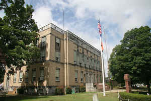
Adair County is a county located in the state of Oklahoma. Based on the 2010 census, the population was 22,286. Its county seat is Stilwell. Adair County was named after the Adair family of the Cherokee tribe. One source says that the county was specifically named for Watt Adair, one of the first Cherokees to settle in the area.
Etymology - Origin of Adair County Name
Named for a prominent Cherokee family of which perhaps the most noted member was Col. William Penn Adair, who represented the Cherokee Nation at Washington from 1866 until his death in 1881.
Demographics:
County QuickFacts: CensusBureau Quick Facts
Adair County History
The county was created in 1906 from the Goingsnake and Flint districts of the Cherokee Nation. There was a decade-long struggle over what town would become the county seat between Stilwell and Westville. When the county was formed, Westville was identified as the county seat, due partly to its location at the intersection of two major railroads: the Kansas City Southern Railway and the St. Louis - San Francisco Railway. The county seat was moved to Stilwell in 1910.
Oklahoma History Center
Located in northeastern Oklahoma, Adair County is bounded on the
east by the state of Arkansas. Cherokee County borders Adair to the
west, to the north is Delaware County, and to the south is Sequoyah
County. The county's major highways are US Highway 62, an
east-west route, and US Highway 59, a north-south road. Other
east-west routes include State Highways 51 and 100. Adair County has
577.03 square miles of land and water. The region is part of the
Ozark plateau uplift, which are the tree-covered foothills of the
Boston Mountains. The north and central portions of Adair County are
drained by the Illinois River and Barren Fork, Evansville, and Caney
creeks. Near Stilwell are Sallisaw and Little Lee creeks....ADAIR
COUNTY
Geography: Land and Water
As reported by the Census Bureau, the county has a total area of 577 square miles (1,490 km2), of which 573 square miles (1,480 km2)
is land and 3.6 square miles (9.3 km2) (0.6%) is water.
The county is part of the Ozark plateau uplift, the tree-covered foothills of the Boston Mountains. North and central Adair County are
drained by the Illinois River and three creeks. Two more creeks lie near Stilwell.
Neighboring Counties
Bordering counties are as follows:
- Delaware County (north)
- Benton County, Arkansas (northeast)
- Washington County, Arkansas (east)
- Crawford County, Arkansas (southeast)
- Sequoyah County (south)
- Cherokee County (west)
Education


Click Image to Enlarge
