


Click Image to Enlarge
Oklahoma Counties
There are seventy-seven counties in Oklahoma. Oklahoma originally had seven counties when it was first organized as the Oklahoma Territory. These counties were designated numerically, first through seventh. New counties added after this were designated by letters of the alphabet. The first seven counties were later renamed. The Oklahoma Constitutional Convention named all of the counties that were formed when Oklahoma entered statehood in 1907. Only two counties have been formed since thenPushmataha County, Oklahoma
Pushmataha County Education, Geography, and History
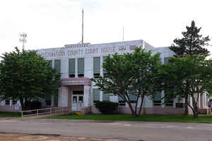
Pushmataha County is a county located in the southeastern part of the state of Oklahoma. Based on the 2010 census, the population was 11,572. Its county seat is Antlers. The county was created at statehood from part of the Choctaw Nation, whose capital was at the town of Tuskahoma. It was named for an important Choctaw chief.
Etymology - Origin of Pushmataha County Name
Named after the great Choctaw Chieftain, Apushmataha, meaning "the sapling is ready, or finished, for him."
Demographics:
County QuickFacts: CensusBureau Quick Facts
Pushmataha County History
Pushmataha County's modern origins lie in the Choctaw Nation, during its time as a sovereign nation in the Indian
Territory, prior to Oklahoma statehood.
The Choctaw territory comprising the modern county was, until statehood in 1907, divided among two of the three administrative districts, or
regions, comprising the nation - Pushmataha and Apukshunnubbee. Each of these districts was subdivided into counties. The modern county fell
within Cedar County, Nashoba County and Wade County of the Apukshunnubbee District - today the county's eastern area - and Jack's Fork County
and Kiamitia County (Kiamichi County) of the Pushmataha District - today the county's western area
Although the Five Civilized Tribes of the Indian Territory opposed their incorporation within a United States state, by the turn of the
20th century, statehood of some sort appeared inevitable. A group of leaders from the Five Civilized Nations - Choctaw, Cherokee, Chickasaw,
Creek, and Seminole - met at Muskogee in an attempt to seize the initiative and fashion a state of the Indian Territory, to be controlled by
Native Americans. Their meeting, which came to be known as the Sequoyah Constitutional Convention, established the proposed State of Sequoyah.
The leaders meeting in Muskogee recognized that the counties of the Choctaw Nation, drawn to reflect easily recognizable natural landmarks
such as mountain ranges and rivers, were not economically viable. Jack's Fork County, as example - in which Antlers was located - was a vast
territory whose tiny county seat was Many Springs (modern-day Daisy, Oklahoma|Daisy). But the only commercially successful town within its
boundaries was Antlers, and it was situated in its far southeastern corner.
County boundaries for the new State of Sequoyah were crafted to take into account the existing towns and the range of their commercial
interests. County seats were centered geographically within the populations of the areas they would govern.
The area comprising modern-day Pushmataha County, Oklahoma proved a particular challenge. Huge areas of its east were virtually empty of
people. Its population was centered in towns along the railroad in the Kiamichi River valley. A county was eventually drawn with the crescent
of the Kiamichi River valley forming its commercial heart, and it was to be called Pushmataha County, Sequoyah.
Records of the Sequoyah Constitutional Convention's committee on counties are lost, and no evidence remains to document the committee's
deliberations. They wanted an area named after their Chief Pushmataha, and singled out the future Pushmataha County, Sequoyah for this honor.
Then, as now, Hugo's businesses served an area extending as far north as Kent, Speer, Hamden, and nearly to Rattan. As a result, the county
boundary for the proposed Hitchcock County - with Hugo as county seat - was established along the line of the existing boundary between
Choctaw and Pushmataha counties. Similar considerations governed the establishment of the county's northern, eastern and western borders.
The United States Congress failed to admit the proposed State of Sequoyah into the Union, preferring to await a possible federation of the
Indian Territory and Territory of Oklahoma. This was soon proposed, and in 1907 the Oklahoma Constitutional Convention met in Guthrie,
Oklahoma Territory to create the new State of Oklahoma. During these deliberations it became clear that the work of the Sequoyah
Constitutional Convention had been groundbreaking: the Guthrie meeting essentially adopted nearly the same boundaries for Pushmataha County,
Oklahoma as were proposed earlier for it in the state of Sequoyah, again identifying Antlers as county seat.
Oklahoma History Center
Located in southeastern Oklahoma, Pushmataha County is bounded by Le Flore County on the northeast, McCurtain County
on the east, Choctaw County on the south, Atoka County on the west, Pittsburg County on the northwest, and Latimer
County on the north. At the turn of the twenty-first century the incorporated towns included Albion, Clayton, Rattan,
and Antlers, the county seat. Named for the Pushmataha District of the Choctaw Nation and Choctaw Chief Pushmataha, the
county lies mostly in the Ouachita Mountains physiographic region with a thin band across the southern part of the
county lying within the Coastal Plains region. The county has 1,422.78 square miles of total land and water area and is
drained by the Little and Kiamichi rivers. Pushmataha County's prehistory is represented by three sites dating to the
Paleo period (prior to 6000 B.C.), 145 dating to the Archaic period (6000 B.C. to A.D. 1), fifty to the Woodland period
(A.D. 1 to 1000), and twenty-two to the Plains Village period (A.D. 1000 to 1500). Of significance is the Kiamichi Fish
Weir Site, a stone fish weir (trap) dating to the late Archaic period....PUSHMATAHA
COUNTY
Geography: Land and Water
As reported by the Census Bureau, the county has a total area of 1,423 square miles (3,690 km2), of which 1,396 square miles
(3,620 km2) is land and 27 square miles (70 km2) (1.9%) is water.
Most of Pushmataha County is mountainous, with the exception of a relatively flat agricultural belt along the county's southern border. The
Kiamichi River valley forms a crescent through the county from northeast to southwest, and most of the human habitation has occurred inside
this crescent.
The Kiamichi Mountains, a sub-range of the Ouachita Mountains, occupy most of the land in the county. This mountain chain has never been
formally defined, nor have its neighboring mountain chains, such as the Winding Stair Mountains to the county's north or the Bok Tuklo
Mountains to its east. The Kiamichi Mountains range to a height of approximately 1,650 feet (500 m) in the county. Many of its summits are not
in the classical, conical shape but rather are long furrows. The mountains are difficult for roads to penetrate, and large areas of the county
are virtually empty of population.
Two rivers, the Kiamichi and Little River, flow through the county with their numerous tributaries. Sardis Lake, a flood control facility in
the northeastern part of the county, impounds the waters of Jack Fork Creek. Hugo Lake, in Choctaw County, provides a similar function on the
main stem of the river. It backs up the Kiamichi River northward into the county. Smaller impoundments include Clayton Lake, Nanih Waiyah
Lake, Ozzie Cobb Lake and Pine Creek Lake.
Major tributaries of the Kiamichi River include Jack Fork Creek, Buck Creek, and Ten Mile Creek. Black Fork Creek and Pine Creek are the most
significant tributaries of Little River.
Two areas designated for wildlife management by the State of Oklahoma may be found in the county: the Pine Creek Wildlife Management Area, in
the southeastern part of the county adjacent to Pine Creek Lake, and the Pushmataha Wildlife Management Area, near Clayton. Both areas are
scientifically managed, and a multi-year research project regarding species management is underway in the Pushmataha Wildlife Management Area.
Interesting geographical features in the county include Rock Town, a small region of distinctive boulders in Johns Valley; Umbrella Rock near
Clayton; McKinley Rocks near Tuskahoma; and the Potato Hills - unusually serrated landforms near Tuskahoma.
Neighboring Counties
Bordering counties are as follows:
- Latimer County (north)
- Le Flore County (northeast)
- McCurtain County (east)
- Choctaw County (south)
- Atoka County (west)
- Pittsburg County (northwest)
Education


Click Image to Enlarge
