


Click Image to Enlarge
South Carolina Counties
South Carolina is made up of fourty-six counties. They range in size from 392 square miles (1,016 square kilometers) in the case of Calhoun County to 1,358 square miles (3,517 square kilometers) in the case of Charleston County. The least populous county is McCormick County, with only 9,958 residents, while the most populous county is Greenville County, with a population of 395,357, despite the state's most populous city, Columbia, being located in Richland County.York County, South Carolina
York County Education, Geography, and History
York County is a county located in the north-central section of the state of South Carolina. Based on the 2010 census, the population was
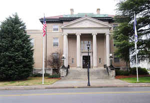
226,073. Its county seat is York, South Carolina, and its largest city is Rock Hill.
York County is included in the Charlotte-Concord-Gastonia, NC-Rock Hill SC Metropolitan Statistical Area.
Etymology - Origin of York County Name
Williamsburg is named for Prince William Augustus, Duke of Cumberland, son of George II of Great Britain.
Demographics:
County QuickFacts: CensusBureau Quick Facts
York County History
York County and its county seat were named for York County, Pennsylvania. The county was first established in 1785 as part of Camden District. From 1791 to 1800 it was part of Pinckney District, and it became a separate district when Pinckney was dissolved in 1800. Part of the county went to form Cherokee County in 1897. When European settlers arrived, this part of the state was inhabited by the Catawba Indians. The Catawbas signed a treaty with the English in 1763, relinquishing their rights to much of their land. This treaty opened up the area to Scotch-Irish settlers moving down from Pennsylvania and up from the lowcountry. The Catawba Nation is now the only federally-recognized Indian tribe in the state. Two battles were fought in this area during the Revolutionary War, Williamson's Plantation (July 12, 1780) and Kings Mountain (October 7, 1780); the latter battle was a major victory for the Americans. Small-scale cotton farming was prevalent in the county in the nineteenth century, but textile mills became important in the twentieth century, contributing to the growth of the county's largest city, Rock Hill.
Geography: Land and Water
York County is located in north central South Carolina, along the North Carolina border. Its natural boundaries
are the Broad River on the west and the Catawba River on the east. All of York County is within the piedmont region.
Although heavily wooded in many rural areas and retaining a predominantly rural character in its western half, York
County is part of the greater Charlotte metropolitan region and includes Rock Hill, the county's largest city, as
well as the smaller towns of Clover, Fort Mill, Hickory Grove, McConnells, Sharon, Tega Cay, and York and increasing
residential development along Lake Wylie.
As reported by the Census Bureau, the county has a total area of 696 square miles (1,802 km2), of which, 682
square miles (1,768 km2) of it is land and 13 square miles (34 km2) of it (1.91%) is water.
Neighboring Counties
Bordering counties are as follows:
- Gaston County, North Carolina - north
- Mecklenburg County, North Carolina - northeast
- Lancaster County, South Carolina - east
- Chester County, South Carolina - south
- Union County, South Carolina - southwest
- Cherokee County, South Carolina - west
- Cleveland County, North Carolina - northwest
Education


Click Image to Enlarge
